| Date: | |
|---|---|
| Description: | This map shows the township and range system, sections, dam locations, railroads, roads, selected buildings, and lakes and streams in Sawyer County, Wiscon... |

| Date: | 1909 |
|---|---|
| Description: | This 1909 bird's-eye view of Madison and the surrounding Four Lakes region shows roads, railroads, selected buildings in Madison, and points of interest ar... |

| Date: | 1923 |
|---|---|
| Description: | This topographical map of Devil's Lake State Park, Sauk County, Wisconsin, is based on 1922-1923 surveys of the area by the University of Wisconsin Summer ... |

| Date: | 1919 |
|---|---|
| Description: | "Map showing the main travelled State and Federal Highways upon which the County Board proposes to expend $1,200,000 for permanent improvements, if you wil... |

| Date: | 1970 |
|---|---|
| Description: | Map features a legend of roads, trails, points of interest, buildings, and types of vegetation. To the right are "ARBORETUM REGULATIONS" regarding hours, p... |

| Date: | 1876 |
|---|---|
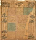
| Description: | Map shows townships and sections, landownership and acreages, roads, railroads, post offices, and farms. Sections appear in pink, yellow, and blue. On the ... |

| Date: | 1967 |
|---|---|
| Description: | This map of Cedarburg includes a list of historic buildings in the left margin. The map was created by the Ozaukee County Historical Society for Cedarburg'... |

| Date: | 1800 |
|---|---|
| Description: | This map of North La Crosse is ink and pencil on paper and shows lot ownership and buildings. |

| Date: | 1800 |
|---|---|
| Description: | This map of the Little Kaukalin Region is ink on paper and shows Little Kaukalin Rapids, Black Bird Island, buildings, trails, meadows and woods, and a sug... |

| Date: | 1938 |
|---|---|
| Description: | This map shows buildings, lots, parks, schools, pumping stations, sites reserved for churches, and water towers. |

| Date: | 1910 |
|---|---|
| Description: | This blue print map shows original lakes, area to be covered by Chippewa Flowage (flow-lines for contours 1310 and 1315), dam sites, roads, and buildings. |

| Date: | 1900 |
|---|---|
| Description: | This photocopy map shows proposed buildings and building use at Fort Crawford. |

| Date: | 1900 |
|---|---|
| Description: | This photocopy map shows marshes, woods, buildings, and selected features including islands, mounds, old Fort Crawford, and "new site for a fort in questio... |

| Date: | 1930 |
|---|---|
| Description: | This photocopy map includes cross section of buildings. |
If you didn't find the material you searched for, our Library Reference Staff can help.
Call our reference desk at 608-264-6535 or email us at: