 Filter: Categories of Wisconsin Historical Images
Filter: Subject of Bridges
Filter: Year of 1800-1899
Filter: County of Columbia
Filter: Categories of Wisconsin Historical Images
Filter: Subject of Bridges
Filter: Year of 1800-1899
Filter: County of Columbia

| Date: | 1868 |
|---|---|
| Description: | This 1868 birds-eye view depicts the buildings, streets, railroad, vegetation and topography of Columbus, Wisconsin. The high school, cemetery, railroad de... |

| Date: | 1868 |
|---|---|
| Description: | Bird's-eye map of Portage, with insets of the Court House and the Public School. |

| Date: | 1874 |
|---|---|
| Description: | Bird's-eye map of Lodi, with inset of Public School. Includes index of churches and points of interest. |
| Date: | 1877 |
|---|---|
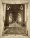
| Description: | View of the lower level of the Chicago, Milwaukee, and St. Paul railroad bridge at the Wisconsin Dells that would have been used by pedestrians and horse-d... |

| Date: | 1878 |
|---|---|
| Description: | View from riverbank of the Chicago Milwaukee and St. Paul railroad locomotive no. 142 on the Kilbourn bridge. |
| Date: | 03 21 1881 |
|---|---|
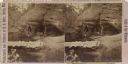
| Description: | Four women gather in the Diamond Grotto, a notable land form in the Wisconsin Dells. There is a rustic bridge in the foreground. |

| Date: | 1890 |
|---|---|
| Description: | Group of tourists and crew members on the bow deck of the DELL QUEEN, an excursion boat that operated on the Wisconsin River at Wisconsin Dells. |

| Date: | 1855 |
|---|---|
| Description: | This map shows landownership, lot and block numbers, streets, a canal, bridges, Fort Winnebago, the Wisconsin River, and the Fox River. Relief is shown by ... |
If you didn't find the material you searched for, our Library Reference Staff can help.
Call our reference desk at 608-264-6535 or email us at:
