 Filter: Categories of Wisconsin Historical Images
Filter: Subject of Bridges
Filter: Subject of human settlements
Filter: Categories of Wisconsin Historical Images
Filter: Subject of Bridges
Filter: Subject of human settlements
| Date: | 1918 |
|---|---|
| Description: | View of the Ringling Brothers Circus winter quarters from across the Baraboo River, looking due north. The brick building, center, was one of the two "Cat ... |
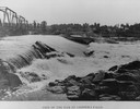
| Date: | 1918 |
|---|---|
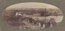
| Description: | View of waterfall, bridge, Baraboo river, and town from the riverbank. |
| Date: | |
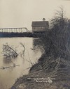
|---|---|
| Description: | View of the bridge over water, with a building behind it. |
| Date: | 1905 |
|---|---|
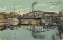
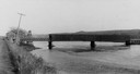
| Description: | View of the Rock River with the Northwestern Railroad Bridge in the foreground and Beloit in the background. Caption reads: "Bird's-Eye View of River, Belo... |
| Date: | 1900 |
|---|---|
| Description: | Oval-framed view of the industrial area along the Rock River. |
| Date: | 1905 |
|---|---|
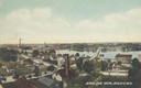
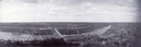
| Description: | View towards river. Caption reads: "Bird's Eye View, Beloit, Wis." |
| Date: | 1900 |
|---|---|
| Description: | View across water towards the Huron Street bridge. Caption reads: "Huron Street Bridge, Berlin, Wis." |
| Date: | 1920 |
|---|---|
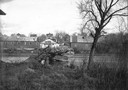
| Description: | View of old bridge, river and buildings in downtown Black Falls River in the winter. |
| Date: | 1925 |
|---|---|
| Description: | View of bridge over Black River Falls, looking at downtown buildings. |
| Date: | 1923 |
|---|---|
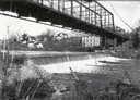
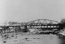
| Description: | Elevated view of a bridge over the Black River during construction. It was built during 1923 and 1924 by the Wausau Iron Works. Tom Cleary was the Resident... |
| Date: | 1930 |
|---|---|
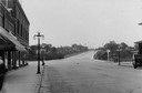
| Description: | View of downtown, with a bridge and buildings in the background and storefronts in the foreground. |
| Date: | 1890 |
|---|---|
| Description: | Trempealeau River and its banks, with a building and bridge in the background. Caption reads: "Trempealeau River Scene, Blair, Wis." |

| Date: | 1920 |
|---|---|
| Description: | Aerial view of the last covered bridge, which is no longer standing. |
| Date: | 1900 |
|---|---|
| Description: | View from road of a partially covered bridge. Industrial buildings are near the entrance to the bridge on the left. |

| Date: | 1930 |
|---|---|
| Description: | View of bridge and Brule River monument. Placed where the Brule River is crossed by the Memorial Highway from Superior to Brule and Ashland (Highway 2). |
| Date: | 1910 |
|---|---|
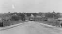
| Description: | Aerial view of town, with a river and the horizon in the distance. |

| Date: | 1900 |
|---|---|
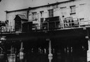
| Description: | Elevated view of the brewery dwarfed by the overhead bluffs. The brewery was built by William Schmitz. George Scheibl ran the brewery from 1899 until his d... |
| Date: | 1900 |
|---|---|
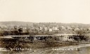
| Description: | Bird's-eye view of Cazenovia, with a bridge in the foreground, the town, and in the distance a low hill in the background. Caption reads: "Bird's Eye View... |
| Date: | 1910 |
|---|---|
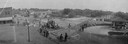
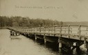
| Description: | View of the Narrows Bridge, with a group of people on the left sitting and standing in a boat. The far shoreline is tree covered. Caption reads: "The Narro... |
| Date: | |
|---|---|
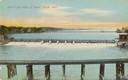
| Description: | Dam and bridge near Chippewa Falls, looking across the river towards a few buildings on the opposite bank. Caption at bottom reads: "View of the Dam at Chi... |
If you didn't find the material you searched for, our Library Reference Staff can help.
Call our reference desk at 608-264-6535 or email us at: