Filter: Categories of Wisconsin Historical Images
Filter: Subject of Bridges
Filter: Subject of aerial photographs
Filter: Categories of Wisconsin Historical Images
Filter: Subject of Bridges
Filter: Subject of aerial photographs

| Date: | 01 1934 |
|---|---|
| Description: | Aerial view of New Butler, in Waukesha County. |
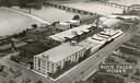
| Date: | 1931 |
|---|---|
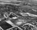
| Description: | Aerial view of International Harvester's Rock Falls Works. The factory was owned by the Keystone Manufacturing Company until 1904, when the company was pur... |

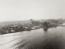
| Date: | 1930 |
|---|---|
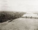
| Description: | Aerial view of the city and the river. |

| Date: | 1920 |
|---|---|
| Description: | Aerial view of the last covered bridge, which is no longer standing. |

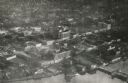
| Date: | 1910 |
|---|---|
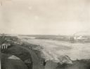
| Description: | Aerial view of town, with a river and the horizon in the distance. |

| Date: | 1950 |
|---|---|
| Description: | Aerial view of main street. There is a bridge with a stream flowing under it in the foreground. |
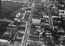
| Date: | 1920 |
|---|---|
| Description: | Aerial view of the commercial district on the east side of the Fox River. Left to right: Hurlbut Coal Company; suggested location for small terminal; Main... |
| Date: | 1924 |
|---|---|
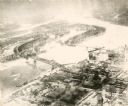
| Description: | Aerial view of Green Bay's commercial district, bridges, and water. |
| Date: | 1920 |
|---|---|
| Description: | Aerial view with fishing piers, coal factories, a bridge, and railroad tracks. |
| Date: | 1925 |
|---|---|
| Description: | Aerial view of Green Bay, including the Jorgensen-Blesch Company building and two bridges. |
| Date: | 1920 |
|---|---|
| Description: | Aerial view of with bridges, river, and shoreline. |

| Date: | 1950 |
|---|---|
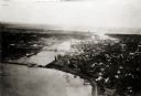
| Description: | Aerial view of downtown and river. |
| Date: | 1955 |
|---|---|
| Description: | Aerial view of Wisconsin Dells. The wing of the airplane is in the left foreground. |
| Date: | 1948 |
|---|---|
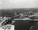
| Description: | The Kimberly-Clark paper mill on the Fox River. |
| Date: | 1948 |
|---|---|
| Description: | Aerial view of the Kimberly-Clark Paper Mill on the Fox River, just east of Appleton. |

| Date: | 1955 |
|---|---|
| Description: | Aerial view of river and town from a military airplane. |

| Date: | 1953 |
|---|---|
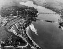
| Description: | Aerial view of La Crosse and the Mississippi River. In the foreground is the new bridge as of 1953. |
| Date: | 1935 |
|---|---|
| Description: | An aerial view of La Crosse and the Mississippi River with the bridge drawn in to show what the finished product would look like. |
If you didn't find the material you searched for, our Library Reference Staff can help.
Call our reference desk at 608-264-6535 or email us at: