 Filter: Categories of Wisconsin Historical Images
Filter: Subject of Blueprints
Filter: Year of 1800-1899
Filter: Categories of Wisconsin Historical Images
Filter: Subject of Blueprints
Filter: Year of 1800-1899

| Date: | 1897 |
|---|---|
| Description: | Topographical map of Stanley McCormick's Riven Rock estate in El Montecito, Santa Barbara County, California. The map is identified as a map of a survey co... |

| Date: | 1899 |
|---|---|
| Description: | Topographical map showing ridges, water courses, boundary lines, and trails and roads near the Stanley McCormick's Riven Rock estate in El Montecito, Santa... |
| Date: | 1899 |
|---|---|
| Description: | Map of the Santa Barbara Channel California area showing property boundaries and some geographical features. The Riven Rock Estate has been outlined in yel... |
| Date: | 1899 |
|---|---|
| Description: | Architectural drawing of the East Elevation of the terrace at Riven Rock, Stanley McCormick's estate in El Montecito, Santa Barbara County, California. The... |

| Date: | 1898 |
|---|---|
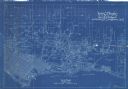
| Description: | This manuscript blueprint map covers property along Winnequah Road in area now part of Monona, Wisconsin. Lake Monona is labeled to the left and posts are ... |

| Date: | 1891 |
|---|---|
| Description: | This blueprint manuscript map shows land owned by Green Bay & Mississippi Canal Co., Meade, Vilas, Patten, and Hewitt. Streets and the Fox River are labele... |

| Date: | 1891 |
|---|---|
| Description: | This blueprint manuscript map shows land owned by Kaukauna Water Power Co., Green Bay & Mississippi Canal Co., A.W. Patten, N.M. Edwards, and M.J. Meade. P... |

| Date: | 10 1891 |
|---|---|
| Description: | This blueprint map shows land ownership and buildings. Text below the title reads: "The La Crosse Heights include the ridge of land with the spurs projecti... |

| Date: | 1880 |
|---|---|
| Description: | This blueprint map shows proposed railroad tracks between Carroll Street and Wisconsin Avenue along Lake Monona. |

| Date: | 1870 |
|---|---|
| Description: | This blueprint map shows lot and block numbers, streets, and right of way for the Two Rivers Branch railroad. The map covers land west to sections 22 and 2... |

| Date: | 1891 |
|---|---|
| Description: | This map shows soft marshland, water channels, solid ground, club boundary and shooting boxes. Big Lake, First Channel, Second Channel, Fout Mile Pond, Mal... |

| Date: | 1890 |
|---|---|
| Description: | This blue line print map created sometime between 1886 and 1916 covers parts of northern Taylor County and eastern Sawyer and Rusk counties Each of the tow... |

| Date: | 1873 |
|---|---|
| Description: | This blueprint map shows water depths by soundings and isolines. To the top left is Duluth, Minnesota. To the bottom right is Superior City, Wisconsin. The... |
If you didn't find the material you searched for, our Library Reference Staff can help.
Call our reference desk at 608-264-6535 or email us at: