 Filter: Categories of Wisconsin Historical Images
Filter: Subject of Blueprints
Filter: Subject of transportation
Filter: Categories of Wisconsin Historical Images
Filter: Subject of Blueprints
Filter: Subject of transportation
| Date: | 01 09 1940 |
|---|---|
| Description: | Blueprint design for a suspension footbridge for Copper Falls State Park. |

| Date: | 1935 |
|---|---|
| Description: | John Seltzer (left) and T.C. Phillips examine a blueprint in the Engineering Department of International Harvester's Fort Wayne Works. |

| Date: | 02 14 1939 |
|---|---|
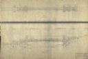
| Description: | Deatiled blueprint (pg 2) for the suspension footbridge in Copper Falls State Park. |
| Date: | 12 14 1939 |
|---|---|
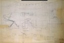
| Description: | Page 1 of detailed blueprints for the suspension footbridge in Copper Falls State Park. |

| Date: | 02 12 1946 |
|---|---|
| Description: | Blueprints details for Signs and Markers for Copper Falls State Park. |

| Date: | 08 1919 |
|---|---|
| Description: | Two women and one man, probably rural school teachers, are standing outdoors near a work bench, reviewing the blueprints to construct a nail box. |

| Date: | 1897 |
|---|---|
| Description: | Topographical map of Stanley McCormick's Riven Rock estate in El Montecito, Santa Barbara County, California. The map is identified as a map of a survey co... |

| Date: | 1899 |
|---|---|
| Description: | Topographical map showing ridges, water courses, boundary lines, and trails and roads near the Stanley McCormick's Riven Rock estate in El Montecito, Santa... |
| Date: | 06 09 1986 |
|---|---|
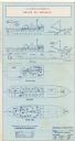
| Description: | A blueprint prepared for Emile de Antonio by the de Pavloff Company in San Francisco. The blueprint is a rendering of "Rainbow Warrior II," a proposed nava... |

| Date: | 06 08 1960 |
|---|---|
| Description: | Blueprint plat of Sunset Hills sub-division. |

| Date: | 1933 |
|---|---|
| Description: | Blue print and blue line print maps that show local streets, Nakoma Country Club, part of Lake Forest, and part of Lake Wingra. A legend is included that s... |

| Date: | 07 28 1934 |
|---|---|
| Description: | This map shows buildings and dimensions of Fort Crawford and hospital overlaid on a plat of existing lots, streets, and closed streets. |

| Date: | 1898 |
|---|---|
| Description: | This manuscript blueprint map covers property along Winnequah Road in area now part of Monona, Wisconsin. Lake Monona is labeled to the left and posts are ... |

| Date: | 1910 |
|---|---|
| Description: | This blue print map shows original lakes, area to be covered by Chippewa Flowage (flow-lines for contours 1310 and 1315), dam sites, roads, and buildings. |

| Date: | 1933 |
|---|---|
| Description: | This blueprint map shows lakes, roads, railroads, townships and sections. A legend is also included that shows highway surface types. |

| Date: | 1920 |
|---|---|
| Description: | This blueprint map covers the boundary area between Lake Superior and the Lac Vieux Desert. The map reads: "Land lines, streams, lakes, railroads, cities a... |

| Date: | 1912 |
|---|---|
| Description: | This blueprint manuscript map shows selected buildings, roads, and the Peshtigo River. |

| Date: | 1891 |
|---|---|
| Description: | This blueprint manuscript map shows land owned by Green Bay & Mississippi Canal Co., Meade, Vilas, Patten, and Hewitt. Streets and the Fox River are labele... |

| Date: | 1891 |
|---|---|
| Description: | This blueprint manuscript map shows land owned by Kaukauna Water Power Co., Green Bay & Mississippi Canal Co., A.W. Patten, N.M. Edwards, and M.J. Meade. P... |

| Date: | 1926 |
|---|---|
| Description: | This blueprint manuscript map shows buildings, railroads, and United States property. Water depths shown by soundings, tints, and isolines. |
If you didn't find the material you searched for, our Library Reference Staff can help.
Call our reference desk at 608-264-6535 or email us at: