 Filter: Categories of Wisconsin Historical Images
Filter: Subject of Blueprints
Filter: Subject of botany
Filter: Categories of Wisconsin Historical Images
Filter: Subject of Blueprints
Filter: Subject of botany
| Date: | 12 11 1936 |
|---|---|
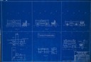
| Description: | Blueprint design for seats for Copper Falls State Park. |
| Date: | 05 21 1936 |
|---|---|
| Description: | Blueprint design for a trail side shelter at Copper Falls State Park. |
| Date: | 01 09 1940 |
|---|---|
| Description: | Blueprint design for a suspension footbridge for Copper Falls State Park. |
| Date: | |
|---|---|
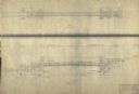
| Description: | Blueprint design of the master plan for Copper Falls State Park. |

| Date: | 02 14 1939 |
|---|---|
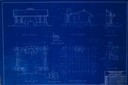
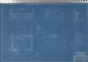
| Description: | Deatiled blueprint (pg 2) for the suspension footbridge in Copper Falls State Park. |
| Date: | 12 14 1939 |
|---|---|
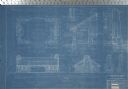
| Description: | Page 1 of detailed blueprints for the suspension footbridge in Copper Falls State Park. |

| Date: | 02 12 1946 |
|---|---|
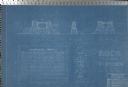
| Description: | Blueprints details for Signs and Markers for Copper Falls State Park. |

| Date: | 07 1957 |
|---|---|
| Description: | Blueprints for highway signs for Devil's Lake State Park. |
| Date: | 05 1936 |
|---|---|
| Description: | Blueprint for Trail Shelter in Devil's Lake State Park. |
| Date: | 05 1936 |
|---|---|
| Description: | Blueprint showing the details for stone shelter in Devil's Lake State Park. |
| Date: | 02 08 1936 |
|---|---|
| Description: | Blueprints for the Signs and Markers for Devil's Lake State Park. |
| Date: | 05 27 1936 |
|---|---|
| Description: | Blueprints for the Bath House in Devil's Lake State Park. |

| Date: | 08 1919 |
|---|---|
| Description: | Two women and one man, probably rural school teachers, are standing outdoors near a work bench, reviewing the blueprints to construct a nail box. |

| Date: | 1927 |
|---|---|
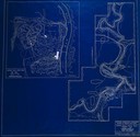
| Description: | Blueprint-style map of Frost Woods on the shore of Lake Monona. The map indicates the locations of Indian mounds, an Indian camp, and various plants. There... |

| Date: | 1897 |
|---|---|
| Description: | Topographical map of Stanley McCormick's Riven Rock estate in El Montecito, Santa Barbara County, California. The map is identified as a map of a survey co... |

| Date: | |
|---|---|
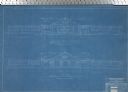
| Description: | Blueprint of the formal garden for Stanley McCormick's Riven Rock estate at El Montecito, Santa Barbara County, California. The blueprint shows different v... |

| Date: | 1933 |
|---|---|
| Description: | Blue print and blue line print maps that show local streets, Nakoma Country Club, part of Lake Forest, and part of Lake Wingra. A legend is included that s... |

| Date: | 1900 |
|---|---|
| Description: | This blue line print map shows land use, cables, U.S.L.S.S. walk and clearing, and front and rear range lights on the Porte des Morts Passage. Tree types a... |

| Date: | 1920 |
|---|---|
| Description: | This blue print map shows landownership between 1913 and 1916, topography, railroads, and roads. The map covers the vicinity of Perrot State Park. |
If you didn't find the material you searched for, our Library Reference Staff can help.
Call our reference desk at 608-264-6535 or email us at: