 Filter: Categories of Wisconsin Historical Images
Filter: Subject of Bird's-eye views
Filter: Year of 1900-1999
Filter: Year of 1940-1949
Filter: Categories of Wisconsin Historical Images
Filter: Subject of Bird's-eye views
Filter: Year of 1900-1999
Filter: Year of 1940-1949
| Date: | 1942 |
|---|---|
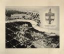
| Description: | Trees interspersed with college buildings in lower half of image, with Fox River bisecting the middle, and a few buildings across the river with open fiel... |

| Date: | 1949 |
|---|---|
| Description: | Color bird's-eye map of the University of Wisconsin-Madison as it was midcentury, with two co-eds, several photographs of campus landmarks around edges, an... |

| Date: | 1948 |
|---|---|
| Description: | Colored map with black and white photographic images in wedges at right and left sides. Map extends from Camp Randal stadium at bottom left corner, to Lake... |

| Date: | 1946 |
|---|---|
| Description: | This bird's-eye-view map shows scenes of land use and farming superimposed on a map of the United States. Agricultural scenes of farming, livestock, and cr... |

| Date: | 1942 |
|---|---|
| Description: | This pictorial bird's-eye-view map shows the United States of America with parts of Canada and Mexico. Landscape, trade, industry, points of interest, peop... |

| Date: | 1940 |
|---|---|
| Description: | Text on front reads: "Birdseye, Business Center, Richland Center, Wis." An aerial view, looking north, of the town situated between tree covered hills. The... |
If you didn't find the material you searched for, our Library Reference Staff can help.
Call our reference desk at 608-264-6535 or email us at: