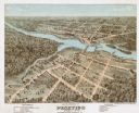
| Date: | 09 1871 |
|---|---|
| Description: | Bird's-eye view of Peshtigo, before it was destroyed by fire on the night of October 8, 1871. |

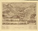
| Date: | 1870 |
|---|---|
| Description: | This bird's-eye-view map shows roads, a river with boats, and homes. The bottom margin of the map includes an index. |

| Date: | 1881 |
|---|---|
| Description: | Bird's-eye map of Marinette, with insets. |

| Date: | 1908 |
|---|---|
| Description: | Colored map showing a panoramic view of Madison in great detail. The Wisconsin State Capitol is located at the center, with Lake Mendota in the background ... |

| Date: | 1890 |
|---|---|
| Description: | Bird's-eye map of Ashland, viewed from Lake Superior, with insets of Prentice Park and Fishery. Population 16,000. Increase in Ten Years, 11,000. |

| Date: | 1853 |
|---|---|
| Description: | Bird's-eye map of Milwaukee looking east toward Lake Michigan from a bluff, long since graded into a slope, at about 6th Street between Wisconsin Avenue an... |

| Date: | 1890 |
|---|---|
| Description: | Bird's-eye map of Beloit with insets of Williams Engine Works, Eclipse Wind Engine Co., and John Foster & Co. Turtle Creek is in the lower section, and the... |

| Date: | 1868 |
|---|---|
| Description: | This 1868 birds-eye view depicts the buildings, streets, railroad, vegetation and topography of Columbus, Wisconsin. The high school, cemetery, railroad de... |

| Date: | 1867 |
|---|---|
| Description: | Bird's-eye map of Green Bay and Fort Howard, Brown Co., depicts street names and street layouts, houses, trees, and the East River. A reference key at the ... |

| Date: | 1873 |
|---|---|
| Description: | Bird's-eye map of La Crosse from the Mississippi River. |

| Date: | 1898 |
|---|---|
| Description: | Bird's-eye map of Milwaukee with prominent streets and buildings identified. Taken from City Hall Tower. |

| Date: | 1906 |
|---|---|
| Description: | Bird's-eye map of South Milwaukee. |

| Date: | 1850 |
|---|---|
| Description: | Bird's-eye view of business district of Oshkosh, "drawn after nature" by the artist. |

| Date: | 1872 |
|---|---|
| Description: | Bird's-eye map of Milwaukee on Lake Michigan. |

| Date: | 2007 |
|---|---|
| Description: | This map of Cedarbug is a bird's-eye map with 8 inset views and an index. The map is a print out of the original map dated 1892 held at the Cedarburg Cultu... |

| Date: | 1878 |
|---|---|
| Description: | Bird's-eye map of Chilton with insets of points of interest, including P.H. Becker's Brewery, Chilton House, and Gutheil's Block. |

| Date: | 1874 |
|---|---|
| Description: | Bird's-eye map of Chippewa Falls. |
If you didn't find the material you searched for, our Library Reference Staff can help.
Call our reference desk at 608-264-6535 or email us at: