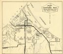
| Date: | 1932 |
|---|---|
| Description: | This map of Superior shows many points of interests including camping, fair grounds, docks, tourist attractions, lakes, roads, and waterways. |

| Date: | 1940 |
|---|---|
| Description: | A woman wearing a bandana on her head is sitting at a picnic table talking with another woman who is standing in front of a tent-style camping trailer. Bot... |
If you didn't find the material you searched for, our Library Reference Staff can help.
Call our reference desk at 608-264-6535 or email us at: