 Filter: Categories of Wisconsin Historical Images
Filter: Subject of Automobiles
Filter: Type of Map or Atlas
Filter: Year of 1900-1999
Filter: Year of 1920-1929
Filter: Categories of Wisconsin Historical Images
Filter: Subject of Automobiles
Filter: Type of Map or Atlas
Filter: Year of 1900-1999
Filter: Year of 1920-1929

| Date: | 1927 |
|---|---|
| Description: | Color map, hand-drawn with comic figures engaged in various activities throughout map. Bordered by the river on the left and Lake Michigan on the right, in... |

| Date: | 1920 |
|---|---|
| Description: | A two-sided map of the state of Wisconsin. The front includes towns and major cities as well as state and county trunk highways. The back includes a smalle... |

| Date: | 1923 |
|---|---|
| Description: | This map shows trails, some in red, for automobiles. The right margin includes a key of markings as well as Minnesota and Wisconsin Highway signs. Communit... |

| Date: | 1920 |
|---|---|
| Description: | This early road map shows the system of roads in Wisconsin, northern Illinois, northeastern Iowa, southeastern Minnesota, and the western portion of Michig... |

| Date: | 1923 |
|---|---|
| Description: | This early road map shows the system of roads in Wisconsin, northern Illinois, northeastern Iowa, southeastern Minnesota, and the western portion of Michig... |
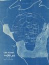
| Date: | 1928 |
|---|---|
| Description: | This blue line map shows the number of carload shipments to northern and central counties, with Mosinee being the central distribution point. Lake Michigan... |

| Date: | 1924 |
|---|---|
| Description: | This map shows railroads, electric lines, and steamship lines. The left margin includes an index of principal cities, and the lower left corner includes a... |

| Date: | 1920 |
|---|---|
| Description: | This map shows the entire state as well as portions of Iowa, Illinois, Minnesota, and Michigan. Counties outlined in yellow, cities, rivers, lakes, and rai... |

| Date: | 1920 |
|---|---|
| Description: | The map shows the entire state with cities, rivers, and lakes labeled. The upper and right margin include inset maps of Racine, Milwaukee, Waukesha, Applet... |

| Date: | 1928 |
|---|---|
| Description: | This map shows the entire state of Wisconsin as well as portions of Michigan, Minnesota, Iowa and Illinois. Lake Michigan, Lake Superior, Lake Winnebago a... |
If you didn't find the material you searched for, our Library Reference Staff can help.
Call our reference desk at 608-264-6535 or email us at: