
| Date: | 1899 |
|---|---|
| Description: | Map of the Santa Barbara Channel California area showing property boundaries and some geographical features. The Riven Rock Estate has been outlined in yel... |
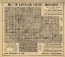
| Date: | 1908 |
|---|---|
| Description: | A map of Langlade County, Wisconsin that shows the townships and ranges, towns, cities and villages, wagon roads, churches, schools, lakes, rivers, railroa... |

| Date: | 1909 |
|---|---|
| Description: | A map of Langlade County, Wisconsin that shows townships and ranges, towns, cities and villages, wagon roads, churches, schools, sawmills, town halls, chee... |
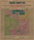
| Date: | 1915 |
|---|---|
| Description: | This 1915 map of Lincoln County, Wisconsin, shows the township and range grid, towns, cities and villages, lakes and streams, residences, churches, school ... |
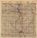
| Date: | 1926 |
|---|---|
| Description: | A map of Lincoln County, Wisconsin that shows the township and range grid, towns, cities and villages, lakes and streams, residences, churches, school hous... |

| Date: | 1900 |
|---|---|
| Description: | A map of Marinette County, Wisconsin shows the township and range system, sections, towns, cities and villages, streams and lakes, railroads, roads, school... |
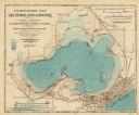
| Date: | 1900 |
|---|---|
| Description: | A Hydrographic map of Lake Mendota that shows the depths of the lake through contour lines and cross sections of the lake. Also shown in the map are the ad... |

| Date: | 1953 |
|---|---|
| Description: | A map of Lake Mendota that shows depths and the locations of various species of fish in lake. The maps also identifies a number of selected roads and stree... |

| Date: | 1908 |
|---|---|
| Description: | A detailed map of Michigan Island and Gull Island in the Apostle Islands group (T51N, R1W, 4 M) that shows sections, landowners, the Michigan Island Lighth... |

| Date: | 1858 |
|---|---|
| Description: | An ink on paper map of Milwaukee County and the eastern portion of Waukesha County that shows the townships of Oak Creek, Franklin, Greenfield, Wauwatosa, ... |

| Date: | 1886 |
|---|---|
| Description: | A hand-colored map of Milwaukee County, Wisconsin that shows the township and range system, sections, towns, roads, railroads and rail stations, cities and... |

| Date: | 1891 |
|---|---|
| Description: | A hand-colored map of Milwaukee County, Wisconsin that shows the township and range system, sections, towns, roads, railroads and rail stations, cities and... |

| Date: | 1896 |
|---|---|
| Description: | A map of Milwaukee County, Wisconsin that shows the township and range system, sections, towns, roads, railroads and rail stations, cities and villages, po... |

| Date: | 1902 |
|---|---|
| Description: | A map of Milwaukee County, Wisconsin that shows the township and range system, sections, towns, roads, railroads and rail stations, cities and villages, po... |
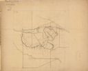
| Date: | 1875 |
|---|---|
| Description: | This manuscript map by Increase Lapham, drawn in the last year of his life, shows landownership, roads and railroads, springs, and boat houses around Ocono... |

| Date: | 1922 |
|---|---|
| Description: | This map from the early to mid-20th century shows the township and range system, towns, cities and villages, roads, railroads, schools, churches, cemeterie... |

| Date: | 1922 |
|---|---|
| Description: | This map from the early to mid-20th century shows the township and range system, towns, cities and villages, roads, railroads, schools, churches, and lakes... |
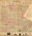
| Date: | 1903 |
|---|---|
| Description: | This 1903 map of Outagamie County, Wisconsin, shows the township and range grid, towns, sections, cities and villages, landownership and acreages, rural ma... |
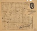
| Date: | |
|---|---|
| Description: | This 1907 map of Outagamie County, Wisconsin, shows the township and range grid, towns, sections, cities and villages, railroads, wagon roads, churches, sc... |
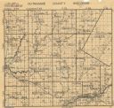
| Date: | 1922 |
|---|---|
| Description: | This map of Outagamie County, Wisconsin, from the first half of the 20th century, shows the township and range grid, towns, sections, cities and villages, ... |
If you didn't find the material you searched for, our Library Reference Staff can help.
Call our reference desk at 608-264-6535 or email us at: