| Date: | 02 26 1887 |
|---|---|
| Description: | Bird's-eye map of Ashland, and the Apostle Islands in Lake Superior. Caption reads: "Ashland and the Apostle Islands." |

| Date: | 1905 |
|---|---|
| Description: | Camp Stella looking south toward the Bayfield County shoreline from an Apostle Island. |

| Date: | 1878 |
|---|---|
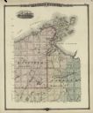
| Description: | A color map detailing Ashland and Bayfield counties, including Lake Superior and the Apostle Islands. |

| Date: | |
|---|---|
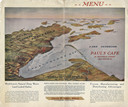
| Description: | Exterior of the menu for Paul's Cafe, with a bird's-eye view map of "Washburn's Natural Deep Water Land Locked Harbor," Chequamegon Bay, and the Apostle Is... |

| Date: | |
|---|---|
| Description: | A map of the Apostle Islands, including the harbor of Bayfield and its surroundings. |
If you didn't find the material you searched for, our Library Reference Staff can help.
Call our reference desk at 608-264-6535 or email us at: