 Filter: Categories of Wisconsin Historical Images
Filter: Subject of Agriculture
Filter: County of Dane
Filter: Subject of land
Filter: Categories of Wisconsin Historical Images
Filter: Subject of Agriculture
Filter: County of Dane
Filter: Subject of land

| Date: | 1873 |
|---|---|
| Description: | Main Street, with its dirt, ruts, cows (and presumably manure), but wide enough for easy hitching of wagons and teams. |

| Date: | 1862 |
|---|---|
| Description: | Camp Randall looking southwest. In April 1861, Governor Alexander Randall asked that the State Agricultural Society fairgrounds be converted into a militar... |
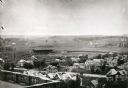
| Date: | 1906 |
|---|---|
| Description: | Elevated view of Camp Randall Field from the top of Bascom Hall, with University Heights in the background. A crowd is in the stands at the stadium, and a ... |
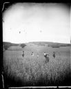
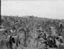
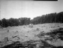
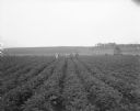
| Date: | 1879 |
|---|---|
| Description: | Five men, facing away from the camera, are standing in a field. Some of them are holding a rakes and a scythe. A boy is in the foreground facing the camera... |

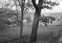
| Date: | 12 01 1962 |
|---|---|
| Description: | A farm road between fields in late sunlight, looking towards Mounds Creek in the vicinity of CTH F. |
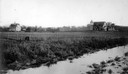
| Date: | 12 01 1962 |
|---|---|
| Description: | A valley and farm in the vicinity of Highway F to the west. |
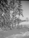
| Date: | 11 06 1960 |
|---|---|
| Description: | A corner of a cornfield in an early snow. |
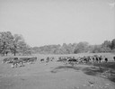
| Date: | 10 10 1945 |
|---|---|
| Description: | Herd of beef cattle in a field near Marshall, Wisconsin. |
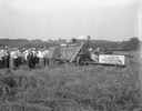
| Date: | 08 02 1926 |
|---|---|
| Description: | Two men operating Case 9-foot combine with a group of men observing, at University of Wisconsin Hill Farm. |
| Date: | 07 20 1929 |
|---|---|
| Description: | Cornfield near Verona, with two rows unfertilized. |
| Date: | 07 20 1929 |
|---|---|
| Description: | Cornfield near Verona, with four rows unfertilized. |
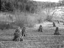
| Date: | 07 10 1929 |
|---|---|
| Description: | Dane County Tuberculosis Sanatorium under construction, with three men with a steam shovel clearing trees. 1202 Northport Drive. J.P. Cullen, Contractor. |
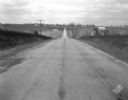
| Date: | 11 08 1928 |
|---|---|
| Description: | Stretch of paved rural highway featuring a proprietary centerline joint, looking towards Mount Horeb from the east. |
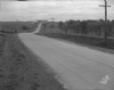
| Date: | 11 08 1928 |
|---|---|
| Description: | Stretch of paved rural highway near Mount Horeb featuring a proprietary centerline joint. |

| Date: | 04 19 1928 |
|---|---|
| Description: | Crushing and Loading equipment at gravel pit. |
| Date: | 03 27 1928 |
|---|---|
| Description: | Winter scene, looking west, of the snow-covered Agriculture Campus, with the Home Economics building at the University of Wisconsin-Madison. |
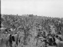
| Date: | 08 02 1926 |
|---|---|
| Description: | Four men in a potato field at Farm Colony, Wisconsin State Hospital for Insane (Mendota Mental Health Institute), Highway 113. |
| Date: | 1926 |
|---|---|
| Description: | Elevated view of Picnic Point on Lake Mendota from the University of Wisconsin-Madison Soils building. |

| Date: | 06 21 1926 |
|---|---|
| Description: | View of the University of Wisconsin-Madison agricultural campus looking east. |
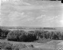
| Date: | 1900 |
|---|---|
| Description: | Wetland, grassy pasture, ring fence are part of the College of Agriculture Farm on the University of Wisconsin Madison campus. |
If you didn't find the material you searched for, our Library Reference Staff can help.
Call our reference desk at 608-264-6535 or email us at: