Filter: Categories of Wisconsin Historical Images
Filter: Subject of Aerial photographs
Filter: Subject of water
Filter: Categories of Wisconsin Historical Images
Filter: Subject of Aerial photographs
Filter: Subject of water
| Date: | 1925 |
|---|---|
| Description: | Aerial view of buildings in the downtown area. |

| Date: | |
|---|---|
| Description: | Aerial view of the southeast, with West Broadway and the South Beltline running through the image. Also shows Nob Hill restaurant, the Toki family farm and... |

| Date: | 1961 |
|---|---|
| Description: | Aerial view of the Duluth-Superior bridge. |

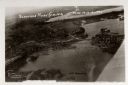
| Date: | 1960 |
|---|---|
| Description: | Aerial view with docks in the foreground. Caption reads: "Superior, Wisconsin." |

| Date: | 1950 |
|---|---|
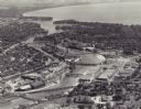
| Description: | An aerial view of town, showing a major industrial area. |

| Date: | 1935 |
|---|---|
| Description: | An aerial view of numerous Manitowoc factories/industries. |

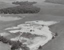
| Date: | 1960 |
|---|---|
| Description: | Aerial view of The Holy Family Convent and College, motherhouse of the Franciscan Sisters of Christian Charity, and liberal arts for the education of Siste... |

| Date: | 1965 |
|---|---|
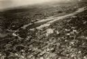
| Description: | Aerial view that encompasses most of the town and part of the Wisconsin River. |

| Date: | 1945 |
|---|---|
| Description: | Aerial view of Taliesin, Frank Lloyd Wright's residence and architectural school complex, with the Wisconsin River visible at the top. Taliesin is located... |
| Date: | 1955 |
|---|---|
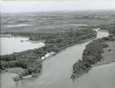
| Description: | Aerial view of "the island" with the Marathon Corporation paper mills. The Fox River flowing out of Lake Winnebago separates the two cities, Neenah and Men... |
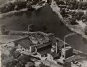
| Date: | 1949 |
|---|---|
| Description: | Aerial view of the George A. Whiting Paper Mill. |
| Date: | 1926 |
|---|---|
| Description: | Aerial view with Wisconsin River. Caption reads: "Schofield Home Coming June 16-17-18-1927". The wing of an airplane is in the right foreground. |
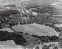
| Date: | 1965 |
|---|---|
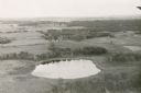
| Description: | Aerial view looking west-northwest over Silver Lake. |
| Date: | 1955 |
|---|---|
| Description: | Aerial view of St. Benedict's convent, mother house, novitiate on the north shore of Lake Mendota (aka Fox Bluff), built in 1953. From 1959 - 1966 it was ... |

| Date: | 1960 |
|---|---|
| Description: | Aerial view of the construction of the interstate highway near Mirror Lake, showing only the early stages of the bridge construction. |
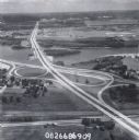
| Date: | 1979 |
|---|---|
| Description: | Interstate I-90 and State Highway 35 at La Crosse. |

| Date: | 1985 |
|---|---|
| Description: | Aerial view of the Duluth-Superior Bridge, officially named in honor of Richard I. Bong, World War II's Ace of Aces, who hailed from nearby Poplar, Wiscons... |
If you didn't find the material you searched for, our Library Reference Staff can help.
Call our reference desk at 608-264-6535 or email us at: