Filter: Categories of Wisconsin Historical Images
Filter: Subject of Aerial photographs
Filter: Subject of transportation
Filter: Categories of Wisconsin Historical Images
Filter: Subject of Aerial photographs
Filter: Subject of transportation

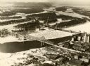
| Date: | 1940 |
|---|---|
| Description: | Aerial view of the bridge spanning the Mississippi River in La Crosse. |
| Date: | 1940 |
|---|---|
| Description: | The bridge spanning the Mississippi River in La Crosse. |
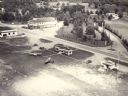
| Date: | 1957 |
|---|---|
| Description: | Aerial view of the Baraboo Wisconsin Dells airport. |
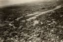
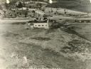
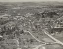
| Date: | 1925 |
|---|---|
| Description: | Aerial view of buildings in the downtown area. |
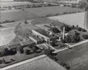
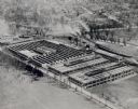
| Date: | 07 1949 |
|---|---|
| Description: | Aerial view of the Carnation Company milk condensery. |

| Date: | |
|---|---|
| Description: | Aerial view of the southeast, with West Broadway and the South Beltline running through the image. Also shows Nob Hill restaurant, the Toki family farm and... |

| Date: | 1955 |
|---|---|
| Description: | Aerial view of Mineral Point showing State Highway 23-39 under construction. |

| Date: | 1955 |
|---|---|
| Description: | An aerial view of Mineral Point showing the construction of State Highway 23-39. |

| Date: | 1961 |
|---|---|
| Description: | Aerial view of the Duluth-Superior bridge. |

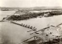
| Date: | 1960 |
|---|---|
| Description: | Aerial view with docks in the foreground. Caption reads: "Superior, Wisconsin." |

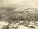
| Date: | 1950 |
|---|---|
| Description: | An aerial view of town, showing a major industrial area. |

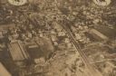
| Date: | 1935 |
|---|---|
| Description: | An aerial view of numerous Manitowoc factories/industries. |

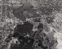
| Date: | |
|---|---|
| Description: | Aerial view of a full Camp Randall Stadium during half-time of a football game. The band is on the field in formation to spell "UW." |
| Date: | 1935 |
|---|---|
| Description: | Aerial view of town. Caption reads: "No. 25. Markesan, in Green Lake county, on state trunk highway 103, is a town of homes. Its inhabitants number 1,000." |
If you didn't find the material you searched for, our Library Reference Staff can help.
Call our reference desk at 608-264-6535 or email us at: