Filter: Categories of Wisconsin Historical Images
Filter: Subject of Aerial photographs
Filter: Subject of botany
Filter: Categories of Wisconsin Historical Images
Filter: Subject of Aerial photographs
Filter: Subject of botany
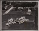
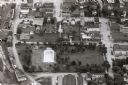
| Date: | 1957 |
|---|---|
| Description: | Aerial view of various buildings and roads. |

| Date: | 1960 |
|---|---|
| Description: | Aerial view of the construction of the interstate highway near Mirror Lake, showing only the early stages of the bridge construction. |

| Date: | 11 1951 |
|---|---|
| Description: | Aerial view of US Highway 14 southeast of La Crosse descending into Mormon Coulee. The original caption of the print, which is undated, describes the road ... |

| Date: | 1979 |
|---|---|
| Description: | Aerial view of Interstate I-90/94 at Camp Douglas, looking northwest. |

| Date: | 1985 |
|---|---|
| Description: | Aerial view of the Duluth-Superior Bridge, officially named in honor of Richard I. Bong, World War II's Ace of Aces, who hailed from nearby Poplar, Wiscons... |
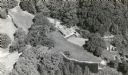
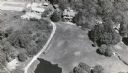
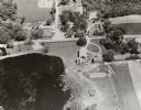
| Date: | 1954 |
|---|---|
| Description: | Aerial view of the Gonstead residence, owned by a well-known chiropractor and designed by Herb Fritz, architect, a student of Frank Lloyd Wright. |
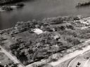
| Date: | 1960 |
|---|---|
| Description: | Aerial view of Villa Louis on the Mississippi River, and adjacent buildings. |

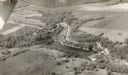
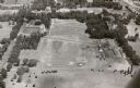
| Date: | 1965 |
|---|---|
| Description: | Aerial view looking north-northwest. View includes houses, roads, farm buildings, tractor-trailors (parked), other buildings. |
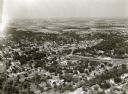
| Date: | 1957 |
|---|---|
| Description: | Aerial view of downtown, including park, church, and stores. |
| Date: | 1957 |
|---|---|
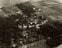
| Description: | Aerial view of Campion College of the Sacred Heart. |
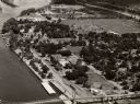
| Date: | 1958 |
|---|---|
| Description: | Aerial view of town. A bridge over the Mississippi River is in the foreground. |

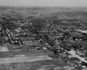
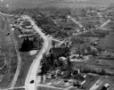
| Date: | 1957 |
|---|---|
| Description: | Aerial view of town including water tower, city streets, houses, and other buildings. |
| Date: | 1965 |
|---|---|
| Description: | Aerial view, looking east. Highway 49 is at center. |

| Date: | 1930 |
|---|---|
| Description: | Aerial view looking east at Mt. Trempealeau from Brady's Bluff in Perrot State Park. The Mississippi River is visible along the bluffs at upper left, and t... |
| Date: | 1935 |
|---|---|
| Description: | Aerial view of the Northern Wisconsin Hospital for the Insane. |
If you didn't find the material you searched for, our Library Reference Staff can help.
Call our reference desk at 608-264-6535 or email us at: