 Filter: Categories of Wisconsin Historical Images
Filter: Subject of Advertising
Filter: Year of 1900-1999
Filter: Type of Map or Atlas
Filter: Categories of Wisconsin Historical Images
Filter: Subject of Advertising
Filter: Year of 1900-1999
Filter: Type of Map or Atlas

| Date: | 1926 |
|---|---|
| Description: | Pages 21 and 22 from the 1926 schedule are a map showing the routes of the Goodrich Transit Company, Great Lakes Transit Company, Detroit and Cleveland Lin... |

| Date: | 1930 |
|---|---|
| Description: | Page 8 of the 1930 schedule is a map of the routes of the Goodrich Steamship Lines in Lake Michigan and Lake Huron. |

| Date: | 1926 |
|---|---|
| Description: | Map of the routes of the screw-driven passenger/freight vessels of the Michigan Transit Company for 1926. |

| Date: | 1930 |
|---|---|
| Description: | Map of the routes of the screw passenger and freight vessels of the Michigan Transit Company. Includes a picture of the Park Place hotel in Traverse City, ... |

| Date: | 1913 |
|---|---|
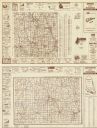
| Description: | A wall atlas of Sauk County, Wisconsin, displaying its 22 towns. On the left side are advertisements for local businesses. |

| Date: | 1920 |
|---|---|
| Description: | A two-sided map of the state of Wisconsin. The front includes towns and major cities as well as state and county trunk highways. The back includes a smalle... |

| Date: | 1949 |
|---|---|
| Description: | This color map includes historical descriptions of select areas and a short article on the history of Wisconsin. The major highways in the state shown on t... |

| Date: | 1923 |
|---|---|
| Description: | This map shows trails, some in red, for automobiles. The right margin includes a key of markings as well as Minnesota and Wisconsin Highway signs. Communit... |

| Date: | 1904 |
|---|---|
| Description: | A brochure for the lake region of north-eastern Illinois and south-eastern Wisconsin providing information on summer activities and places to stay in the a... |

| Date: | 1903 |
|---|---|
| Description: | This map of Richland County, Wisconsin, shows land ownership and acreages, the township and range grid, sections, cities, towns and post offices, roads, ra... |

| Date: | 1991 |
|---|---|
| Description: | This 1991 map of Burnett County, Wisconsin, shows Governor Knowles State Forest, wildlife areas, public hunting grounds, and other outdoor recreation facil... |

| Date: | 1905 |
|---|---|
| Description: | This early 20th century map of Door County, Wisconsin, shows the township and range grid, towns, sections, cities and villages, landownership and acreages,... |

| Date: | 1904 |
|---|---|
| Description: | Map shows townships and sections, landownership and acreages, roads and railroads, and selected buildings. "1904" inscribed on map in pen. Includes busines... |

| Date: | 1992 |
|---|---|
| Description: | This 1992 map of Wood County, Wisconsin, shows towns, sections, cities and villages, highways and roads, railroads, and lakes and streams. An inset map of ... |
| Date: | 1984 |
|---|---|
| Description: | On verso: Map of Lafayette County, Wisconsin. Panel title. Shows roads, railroads, and highways. Includes indexes. Also includes advertisements and illustr... |

| Date: | 1940 |
|---|---|
| Description: | Map features advertisements for local businesses on the left and bottom. Map includes a "LEGEND" and "DIRECTORY OF CHURCHES". Streets are labeled as are so... |

| Date: | 1914 |
|---|---|
| Description: | Includes index of University of Wisconsin buildings, churches, and public buildings. Top of Map reads: '"GET A SQUARE DEAL" AT THE COLLEGE BOOK STORE SHOWN... |

| Date: | 1925 |
|---|---|
| Description: | Map produced by the Paul E. Stark Company to advertising sales and services. Bottom of the map features sales records for 1919 to 1925 and a paragraph read... |

| Date: | 1925 |
|---|---|
| Description: | Map produced by the Paul E. Stark Company to advertising sales and services. Bottom of the map features sales records for 1919 to 1925 and a paragraph read... |

| Date: | 1927 |
|---|---|
| Description: | Shows campus buildings, points of interest in surrounding area, and railroads. Advertisements on verso. |
If you didn't find the material you searched for, our Library Reference Staff can help.
Call our reference desk at 608-264-6535 or email us at: