Filter: Categories of Wisconsin Historical Images
Filter: FULL_DATE of 1973
Filter: Subject of rivers
Filter: Categories of Wisconsin Historical Images
Filter: FULL_DATE of 1973
Filter: Subject of rivers

| Date: | 1973 |
|---|---|
| Description: | Cover for the Wisconsin Friends of Our Native Landscape program. Depicted is a river cascading over rocks, and some trees in the foreground. The Wisconsin ... |

| Date: | 1973 |
|---|---|
| Description: | This map is a photocopy of the original plat of Beloit from 1838. The map shows labeled roads, lots, and rivers. |
| Date: | 1973 |
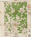
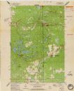
|---|---|
| Description: | This standard U.S.G.S. topographic map was annotated by civil engineer and railroad historian James P. Kaysen to show the location of existing and defunct ... |

| Date: | 1973 |
|---|---|
| Description: | Two men are kneeling on a dock along the Wolf River, each holding two stringers of white bass they have caught. |

| Date: | 1973 |
|---|---|
| Description: | View towards the shoreline of a river, with three boys sitting on the bank in the foreground. There is a building among trees on the opposite shoreline. An... |
| Date: | 1973 |
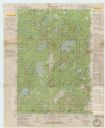
|---|---|
| Description: | This standard U.S.G.S. topographic map was annotated by civil engineer and railroad historian James P. Kaysen to show the location of existing and defunct ... |
If you didn't find the material you searched for, our Library Reference Staff can help.
Call our reference desk at 608-264-6535 or email us at: