Filter: Categories of Wisconsin Historical Images
Filter: FULL_DATE of 1972
Filter: Type of Map or Atlas
Filter: Subject of railroads
Filter: Categories of Wisconsin Historical Images
Filter: FULL_DATE of 1972
Filter: Type of Map or Atlas
Filter: Subject of railroads

| Date: | 1972 |
|---|---|
| Description: | This map on 5 sheets features a title page sheet with business directory and shows section numbers, roads, railroads, saw mills, churches, blacksmith shops... |

| Date: | 1972 |
|---|---|
| Description: | This map of Sheboygan County, Wisconsin, shows the location of churches in the county. Churches are indexed for each town. Also shown are sections, cities ... |

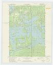
| Date: | 1972 |
|---|---|
| Description: | A topographic map of the Blackwell quadrangle. |
If you didn't find the material you searched for, our Library Reference Staff can help.
Call our reference desk at 608-264-6535 or email us at: