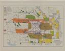
| Date: | 1970 |
|---|---|
| Description: | Color coded map. Legend in the top left hand corner reads: "EXISTING AIRPORT PAVEMENT" (purple), "FUTURE 5-YEAR DEVELOPMENT" (bright pink), "ULTIMATE AIRPO... |

| Date: | 1970 |
|---|---|
| Description: | Map features a legend of roads, trails, points of interest, buildings, and types of vegetation. To the right are "ARBORETUM REGULATIONS" regarding hours, p... |

| Date: | 1970 |
|---|---|
| Description: | This map shows colored-coded land use with a legend in the bottom margin. Land classifications include: Year-round Residential (yellow), Seasonal Residenti... |

| Date: | 1970 |
|---|---|
| Description: | This colored map displays a brief description of tourist attractions in the state, as well as a grid of state parks and recreational facilities. There is a... |
If you didn't find the material you searched for, our Library Reference Staff can help.
Call our reference desk at 608-264-6535 or email us at: