 Filter: Categories of Wisconsin Historical Images
Filter: FULL_DATE of 1965
Filter: Type of Map or Atlas
Filter: County of Milwaukee
Filter: Categories of Wisconsin Historical Images
Filter: FULL_DATE of 1965
Filter: Type of Map or Atlas
Filter: County of Milwaukee

| Date: | 1965 |
|---|---|
| Description: | A map of Milwaukee County showing the county supervisor districts and the city wards. The map also includes the names of those on the on the board of elect... |
| Date: | 1965 |
|---|---|
| Description: | This map shows Milwaukee County Parkway lands, streets, streets not yet constructed, public facilities, schools, churches, and manufacturers. The map inclu... |

| Date: | 1965 |
|---|---|
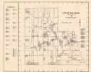
| Description: | This map shows wards, city limits, railroad right of way, proposed future streets, and approximate street elevations. Wards and public schools are labeled ... |

| Date: | 1965 |
|---|---|
| Description: | This map is indexed for public buildings and includes a numbered key on the lower left side. The streets are labeled and Lake Michigan is labeled on the fa... |

| Date: | 1965 |
|---|---|
| Description: | This map shows 32 zoning districts, house numbering system, parks, cemeteries, and Milwaukee County institutional buildings. |
| Date: | 1965 |
|---|---|
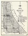
| Description: | This map shows 8 zoning districts, as well as house number system, schools, parks, churches, and points of interest. Lake Michigan is labeled and the lower... |

| Date: | 1965 |
|---|---|
| Description: | This series of 17 maps show boundaries and changes in city limits from 1846 to 1965. The base of all of the maps are the same, Milwaukee and suburbs. All m... |
If you didn't find the material you searched for, our Library Reference Staff can help.
Call our reference desk at 608-264-6535 or email us at: