| Date: | 1964 |
|---|---|
| Description: | Indexed map. Street names are to the left, map is to the right. Lakes, streets, highways, and points of interest are labelled. |

| Date: | 1964 |
|---|---|
| Description: | A simple map of the Mississippi Project. There are symbols at the bottom marking locations for: Voter Registration, Freedom School, Community Center and Pr... |

| Date: | 1964 |
|---|---|
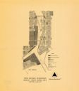
| Description: | This map of Two Rivers shows the Rodgers street fishing area and land use. The map features a legend on the right of the types of land use. The map also sh... |

| Date: | 1964 |
|---|---|
| Description: | This map is a hand-colored blue line print and shows 4 residence zones, 2 business zones, 1 light manufacturing zones, schools, and parks. The zones are ou... |
If you didn't find the material you searched for, our Library Reference Staff can help.
Call our reference desk at 608-264-6535 or email us at: