 Filter: Categories of Wisconsin Historical Images
Filter: FULL_DATE of 1956
Filter: Subject of michigan, lake
Filter: Categories of Wisconsin Historical Images
Filter: FULL_DATE of 1956
Filter: Subject of michigan, lake

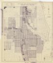
| Date: | 1956 |
|---|---|
| Description: | This map of Racine includes a street directory and index of public buildings. Streets, points of interest, Lake Michigan, and the Root River are labeled. A... |

| Date: | 1956 |
|---|---|
| Description: | This maps shows voting precincts and polling places as well as wards. Streets and the Sheboygan River are labeled. The bottom right of the map features a l... |

| Date: | 1956 |
|---|---|
| Description: | Intended for tourists, this brochure features a map of Milwaukee's central business district as well as general information about parking, beaches and othe... |

| Date: | 1956 |
|---|---|
| Description: | This map shows city, suburban, parochial and other types schools, with an explanation of symbols in the right margin. The original caption for the map read... |
| Date: | 1956 |
|---|---|
| Description: | This blueline print map shows streets, pedestrian pathways, plans to widen existing streets, and streets and alleys vacated and to be vacated. The upper le... |
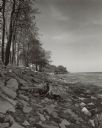
| Date: | 1956 |
|---|---|
| Description: | View along a rocky shoreline lined with trees. The stump of a tree is in the foreground. |

| Date: | 1956 |
|---|---|
| Description: | A boat rack is silhouetted against the lake and a dramatic sky. |

| Date: | 1956 |
|---|---|
| Description: | The Amelia-D is docked at a pier on Green Bay. The shoreline and clouds are in the background. A sailboat and motorboat are moored in the distance. |
If you didn't find the material you searched for, our Library Reference Staff can help.
Call our reference desk at 608-264-6535 or email us at: