| Date: | 1953 |
|---|---|
| Description: | View looking northeast along Mifflin Street near its intersection with Carroll Street on the Capitol Square. |

| Date: | 1953 |
|---|---|
| Description: | Aerial view looking north from the foot of Milwaukee's main thoroughfare, Wisconsin Avenue. Lincoln Memorial Drive winds its way along the lagoon in Juneau... |

| Date: | 1953 |
|---|---|
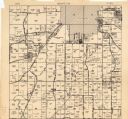
| Description: | Map shows landownership and acreages, roads, and railroads in the Town of Waukesha and part of the city of Waukesha, Waukesha County, Wisconsin. |

| Date: | 1953 |
|---|---|
| Description: | This map shows local streets, roads, highways, Middleton, Monona, Lake Wingra, Lake Monona, Lake Mendota, and an inset map that shows city parking areas. A... |

| Date: | 1953 |
|---|---|
| Description: | Exterior view from sidewalk of City Hall, located at the intersection of West Mifflin Street and Wisconsin Avenue. The Parkway Theatre, featuring the films... |
If you didn't find the material you searched for, our Library Reference Staff can help.
Call our reference desk at 608-264-6535 or email us at: