| Date: | 1953 |
|---|---|
| Description: | An aerial view of Wonewoc showing central businesses and a railroad. |

| Date: | 1953 |
|---|---|
| Description: | A map of Lake Mendota that shows depths and the locations of various species of fish in lake. The maps also identifies a number of selected roads and stree... |

| Date: | 1953 |
|---|---|
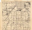
| Description: | Map shows landownership and acreages, roads, and railroads in the Town of Waukesha and part of the city of Waukesha, Waukesha County, Wisconsin. |

| Date: | 1953 |
|---|---|
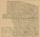
| Description: | This mid 20th century map of Vilas County and northeastern Oneida County, Wisconsin, shows the township and range grid, sections, cities and villages, rail... |

| Date: | 1953 |
|---|---|
| Description: | Three-quarter view from front right of a man loading or unloading a L-120 STD model truck with stake body. The truck is backed into the open door of a bric... |
If you didn't find the material you searched for, our Library Reference Staff can help.
Call our reference desk at 608-264-6535 or email us at: