| Date: | 1952 |
|---|---|
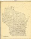
| Description: | This map shows counties, towns, cities, and selected villages, as well as the Menominee Indian Reservation are identified on this U.S. Post Office. Circles... |

| Date: | 1952 |
|---|---|
| Description: | View across street towards the Ephraim Village Hall. Automobiles are parked on both sides of the street. Text on reverse reads: "A view of Ephraim's pic... |
If you didn't find the material you searched for, our Library Reference Staff can help.
Call our reference desk at 608-264-6535 or email us at: