| Date: | 1946 |
|---|---|
| Description: | View from side of a road of an International KR-12 truck equipped with 149 inch wheel base and semi-trailer. There is a cityscape in the background. |

| Date: | 1946 |
|---|---|
| Description: | International truck utilized by K*A*T Corporation for multi-automobile hauling. The truck is parked on a road with a river in the background. |

| Date: | 1946 |
|---|---|
| Description: | Map of Kewaunee County, Wisconsin, shows towns, cities and villages, roads and highways, railroads, schools, lighthouses, place names, town divisions, comm... |

| Date: | 1946 |
|---|---|
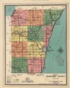
| Description: | Color coded map in pink, yellow, green, and brown of Milwaukee County State and County trunk highways. The map includes a legend of symbols: "STEAM RAIL RO... |

| Date: | 1946 |
|---|---|
| Description: | This colored road map shows automobile roads in Wisconsin as well as portions of nearby states. Information on the quality and type of any road shown (Inte... |

| Date: | 1946 |
|---|---|
| Description: | Two canoes are pulled up on the shoreline in the Flambeau River State Forest. |
If you didn't find the material you searched for, our Library Reference Staff can help.
Call our reference desk at 608-264-6535 or email us at: