| Date: | 1942 |
|---|---|
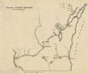
| Description: | This map shows the Wisconsin and Fox River routes in green, and the Milwaukee and Rock River Canal routes in red. Prairie du Chien, Fort Winnebago, Grand C... |

| Date: | 1942 |
|---|---|
| Description: | This map shows surfaces and types of highways. A legend and three county and two local area inset maps are included. The bottom left margin reads: "Traffi... |

| Date: | 1942 |
|---|---|
| Description: | This photocopy plat map represents the relative position and size of the sloughs and islands in the Mississippi River, opposite Prairie du Chien. |

| Date: | 1942 |
|---|---|
| Description: | Black and white aerial view of La Crosse and the Mississippi River, including Riverside Park, the Black River and La Crosse River. |
If you didn't find the material you searched for, our Library Reference Staff can help.
Call our reference desk at 608-264-6535 or email us at: