Filter: Categories of Wisconsin Historical Images
Filter: FULL_DATE of 1940
Filter: Subject of railroads
Filter: Categories of Wisconsin Historical Images
Filter: FULL_DATE of 1940
Filter: Subject of railroads
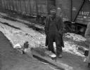
| Date: | 1940 |
|---|---|
| Description: | A man (maybe a railroad worker or a tramp) standing along a railroad track next to a small cooking fire. Railroad cars are in the background. |

| Date: | 1940 |
|---|---|
| Description: | Aerial view of the bridge spanning the Mississippi River in La Crosse. |
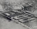
| Date: | 1940 |
|---|---|
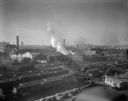
| Description: | Located in West Milwaukee. View from atop a building of a large building located in the center, next to a smokestack. In the foreground is part of a round... |
| Date: | 1940 |
|---|---|
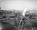
| Description: | Located in West Milwaukee. Trains, cars, tracks, and railroad buildings. The view is taken from the top of a building. |
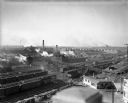
| Date: | 1940 |
|---|---|
| Description: | West Milwaukee. Elevated view of tracks, trains, and buildings. A train roundhouse is located in the background. |
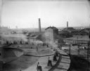
| Date: | 1940 |
|---|---|
| Description: | Elevated view of West Milwaukee shops of the Chicago, Milwaukee and St. Paul railroad. Railroad train cars are stopped on the tracks and smoke is rising fr... |
| Date: | 1940 |
|---|---|
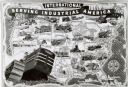
| Description: | Map illustrating the industrial uses of International crawler tractors (TracTracTors) across the United States. Includes the text: "International Serving I... |

| Date: | 1940 |
|---|---|
| Description: | Map of Milwaukee County showing the metropolitan area, in yellow, and the proposed connecting of parkways and boulevards in green. The map also identifies ... |
| Date: | 1940 |
|---|---|
| Description: | This map shows cities and villages, roads, railroads, and lakes and streams in northern Sawyer, northeastern Washburn, southeastern Douglas, and southern B... |

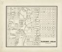
| Date: | 1940 |
|---|---|
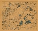
| Description: | This map of Taylor County, Wisconsin, shows the township and range grid, towns, sections, cities and villages, railroads, roads, creameries and cheese fact... |
| Date: | 1940 |
|---|---|
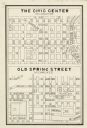
| Description: | This map is pen and ink on paper and is map 2 in a series of 12. The map shows streets, the Milwaukee River, and railroad tracks. |
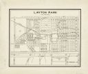
| Date: | 1940 |
|---|---|
| Description: | This map is pen and ink on paper and is map 3 in a series of 12. The map shows streets, the Milwaukee River, and railroad tracks. |
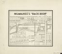
| Date: | 1940 |
|---|---|
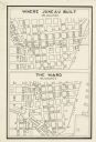
| Description: | This map is pen and ink on paper and is map 5 in a series of 12. The map shows streets, the Milwaukee River, Lake Michigan, and railroad tracks. |
| Date: | 1940 |
|---|---|
| Description: | This map is pen and ink on paper and is map 7 in a series of 12. The map shows streets and a railroad line. |
| Date: | 1940 |
|---|---|
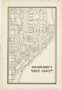
| Description: | This map is pen and ink on paper and is map 8 in a series of 12. The map shows streets and a railroad line. |
| Date: | 1940 |
|---|---|
| Description: | This map is pen and ink on paper and is map 9 in a series of 12. The map shows streets and railroad lines. |
| Date: | 1940 |
|---|---|
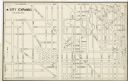
| Description: | This map is pen and ink on paper and is map 10 in a series of 12. The map shows streets and railroad lines. |
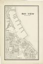
| Date: | 1940 |
|---|---|
| Description: | This map is pen and ink on paper and is map 12 in a series of 12. The map shows streets, railroad lines, the Kinnickinnic River, and Lake Michigan. |

| Date: | 1940 |
|---|---|
| Description: | This blue line print map traced from aerial survey mosaic shows reservation boundary, roads, trails, and railroads. Color manuscript annotations show triba... |
If you didn't find the material you searched for, our Library Reference Staff can help.
Call our reference desk at 608-264-6535 or email us at: