 Filter: Categories of Wisconsin Historical Images
Filter: FULL_DATE of 1940
Filter: Type of Map or Atlas
Filter: County of Milwaukee
Filter: Categories of Wisconsin Historical Images
Filter: FULL_DATE of 1940
Filter: Type of Map or Atlas
Filter: County of Milwaukee

| Date: | 1940 |
|---|---|
| Description: | Map of Milwaukee County showing the metropolitan area, in yellow, and the proposed connecting of parkways and boulevards in green. The map also identifies ... |

| Date: | 1940 |
|---|---|
| Description: | A map of Milwaukee County, showing the route of the county tour of Milwaukee in the dark line, as well as identifying other roads, streets, and the Root, M... |

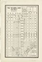
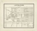
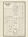
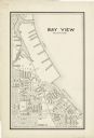
| Date: | 1940 |
|---|---|
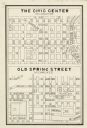
| Description: | This map is pen and ink on paper and is 1 map consisting of 12 sheets. This map includes a numbered key labeling each area, all of which are represented ... |

| Date: | 1940 |
|---|---|
| Description: | Shows Milwaukee and Waukesha counties, and parts of Dodge, Washington, Ozaukee, Jefferson, Walworth, and Racine counties. Includes indexes of "Cities, Town... |

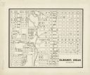
| Date: | 1940 |
|---|---|
| Description: | This map of Granville visually shows different types of zones: agricultural areas, "A" residence, "B" residence, local businesses, commercial and light man... |
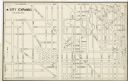
| Date: | 1940 |
|---|---|
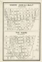
| Description: | This map is pen and ink on paper and is map 2 in a series of 12. The map shows streets, the Milwaukee River, and railroad tracks. |
| Date: | 1940 |
|---|---|
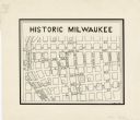
| Description: | This map is pen and ink on paper and is map 3 in a series of 12. The map shows streets, the Milwaukee River, and railroad tracks. |
| Date: | 1940 |
|---|---|
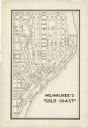
| Description: | This map is pen and ink on paper and is map 3 in a series of 12. The map shows streets, and the Milwaukee River. |
| Date: | 1940 |
|---|---|
| Description: | This map is pen and ink on paper and is map 5 in a series of 12. The map shows streets, the Milwaukee River, Lake Michigan, and railroad tracks. |
| Date: | 1940 |
|---|---|
| Description: | This map is pen and ink on paper and is map 6 in a series of 12. The map shows streets, and the Milwaukee River. |
| Date: | 1940 |
|---|---|
| Description: | This map is pen and ink on paper and is map 7 in a series of 12. The map shows streets and a railroad line. |
| Date: | 1940 |
|---|---|
| Description: | This map is pen and ink on paper and is map 8 in a series of 12. The map shows streets and a railroad line. |
| Date: | 1940 |
|---|---|
| Description: | This map is pen and ink on paper and is map 9 in a series of 12. The map shows streets and railroad lines. |
| Date: | 1940 |
|---|---|
| Description: | This map is pen and ink on paper and is map 10 in a series of 12. The map shows streets and railroad lines. |
| Date: | 1940 |
|---|---|
| Description: | This map is pen and ink on paper and is map 11 in a series of 12. The map shows streets. |
| Date: | 1940 |
|---|---|
| Description: | This map is pen and ink on paper and is map 12 in a series of 12. The map shows streets, railroad lines, the Kinnickinnic River, and Lake Michigan. |
If you didn't find the material you searched for, our Library Reference Staff can help.
Call our reference desk at 608-264-6535 or email us at: