 Filter: Categories of Wisconsin Historical Images
Filter: FULL_DATE of 1935
Filter: Subject of transportation
Filter: Type of Map or Atlas
Filter: Categories of Wisconsin Historical Images
Filter: FULL_DATE of 1935
Filter: Subject of transportation
Filter: Type of Map or Atlas
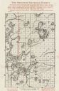
| Date: | 1935 |
|---|---|
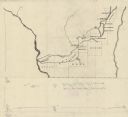
| Description: | This manuscript map shows route of the early military road in Wisconsin from Green Bay (Fort Howard) through Portage (Fort Winnebago) to Fort Blue Mounds a... |

| Date: | 1935 |
|---|---|
| Description: | This three-part map from the U.S. Bureau of Public Roads identifies highways in Wisconsin that have been improved, indicating those which are federal highw... |

| Date: | 1935 |
|---|---|
| Description: | "Drott's conservation guide" map shows the locations of Indian reservations, parks, fish hatcheries, forests, lookout towers, Wisconsin Conservations Commi... |

| Date: | 1935 |
|---|---|
| Description: | This pictorial map of northern Bayfield County, Wisconsin, shows the Chequamegon National Forest, the Red Cliff Indian Reservation, highways and roads, and... |

| Date: | 1935 |
|---|---|
| Description: | This 1935 map shows the Wisconsin River from a point approximately 4 miles south of the city of Wisconsin Dells north to Duck Creek in Adams County. Sectio... |
| Date: | 1935 |
|---|---|
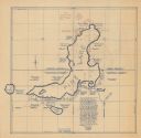
| Description: | This map shows property owners, government lots, and roads around Pine Lake in Rusk and Chippewa Counties. Also shows Silver and McDonald Lakes. "This map ... |
| Date: | 1935 |
|---|---|
| Description: | This map created by the Sheboygan City Engineer department shows five different types of land use in the city in 1935. A legend in the bottom right corner ... |

| Date: | 1935 |
|---|---|
| Description: | This map shows streets, railroads, and city wards. Streets, the Oconto River, and the Green Bay are labeled. The bottom of the map reads: "Compliments of O... |
| Date: | 1935 |
|---|---|
| Description: | This map is a photocopy and shows landownership and acreages, additions to Green Bay, points of interest, roads, and railroads. Hand annotations of green,... |

| Date: | 1935 |
|---|---|
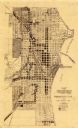
| Description: | This map includes an index on the right margin of industrial plants, churches, schools, and public buildings. Streets, the Rock River, Lake Michigan, parks... |

| Date: | 1935 |
|---|---|
| Description: | This topographical map of the forest preserve shows highways, roads, trails, telephone lines, Native American reservations, Ranger sub-stations, state nurs... |

| Date: | 1935 |
|---|---|
| Description: | This map shows railroads, telephone lines, roads, trails, schools, sub-agency, lookout stations, churches, community centers, and school site and farm. Bil... |

| Date: | 1935 |
|---|---|
| Description: | This map shows the state trunk highway system and county trunk highways. This map show surface type on state and county trunk highways and the locations of... |
| Date: | 1935 |
|---|---|
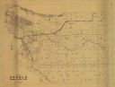
| Description: | This map shows land for sale by the company in northwestern part of Nicolet National Forest. The map also shows shoreline acreages, railroads, roads, trail... |

| Date: | 1935 |
|---|---|
| Description: | This map is presented by Conoco, and shows the major roads, cities, lakes, and rivers, as well as some of the neighboring states. It includes an index, sca... |

| Date: | 1935 |
|---|---|
| Description: | This blue lined map shows the major roads and cities of Wisconsin. The map includes an index, hotel and cafe advertisements, as well as advertisements for ... |

| Date: | 1935 |
|---|---|
| Description: | This blue lined map ("compliments of Black Eagle Oil Company") shows the major roads and cities of Wisconsin. The map includes an index, hotel and cafe adv... |
| Date: | 1935 |
|---|---|
| Description: | This map shows Black Point estate including buildings and signs, as well as a school and store near the village of Linton, country clubs, roads, Yerkes Obs... |

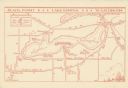
| Date: | 1935 |
|---|---|
| Description: | This road map shows automobile routes across the state of Wisconsin. Advertisements for various hotels are featured along the bottom edge of the map, while... |

| Date: | 1935 |
|---|---|
| Description: | This colored road map comes with a map legend and explanation, as well as an index of cities and towns (and their populations) in Wisconsin. Information ab... |
If you didn't find the material you searched for, our Library Reference Staff can help.
Call our reference desk at 608-264-6535 or email us at: