 Filter: Categories of Wisconsin Historical Images
Filter: FULL_DATE of 1930
Filter: Subject of dwellings
Filter: Type of Map or Atlas
Filter: Categories of Wisconsin Historical Images
Filter: FULL_DATE of 1930
Filter: Subject of dwellings
Filter: Type of Map or Atlas

| Date: | 1930 |
|---|---|
| Description: | Pictorial map of Glacier National Park, Montana and Waterton Lakes National Park, Alberta. Illustrated by Joe Scheurle, it depicts white people, American ... |
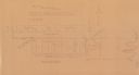
| Date: | 1930 |
|---|---|
| Description: | Map reads: "Plat showing Location of Creamery on apart of The NorthEast 1/4 of the NorthWest 1/4 of Sec 31, T. 30 N.R. 14 W. The map notes creamery buildin... |

| Date: | 1930 |
|---|---|
| Description: | This map shows rivers, lakes, trails, Indian villages, distances, and boundaries of tracts ceded by the Munnomonee, Winnebaygoes, and New York Indians Trib... |
If you didn't find the material you searched for, our Library Reference Staff can help.
Call our reference desk at 608-264-6535 or email us at: