 Filter: Categories of Wisconsin Historical Images
Filter: FULL_DATE of 1930
Filter: County of Milwaukee
Filter: Type of Map or Atlas
Filter: Categories of Wisconsin Historical Images
Filter: FULL_DATE of 1930
Filter: County of Milwaukee
Filter: Type of Map or Atlas
| Date: | 1930 |
|---|---|
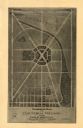
| Description: | This map of Granville shows local streets, local businesses, and industrial areas. Some streets are labeled: "Lovers Lane Road," "Granville Road," and "Bro... |
| Date: | 1930 |
|---|---|
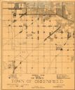
| Description: | This map shows 6 types of zones, as well as cemeteries and streets and includes portions of Greenfield, West Allis, West Milwaukee, and the city of Milwauk... |

| Date: | 1930 |
|---|---|
| Description: | This map shows streets, railways, bus lines, railroads, roads, parks, cemeteries, Lake Michigan, and a proposed harbor. Also included is a legend and on th... |
If you didn't find the material you searched for, our Library Reference Staff can help.
Call our reference desk at 608-264-6535 or email us at: