 Filter: Categories of Wisconsin Historical Images
Filter: FULL_DATE of 1930
Filter: County of Dane
Filter: Type of Map or Atlas
Filter: Categories of Wisconsin Historical Images
Filter: FULL_DATE of 1930
Filter: County of Dane
Filter: Type of Map or Atlas
| Date: | 1930 |
|---|---|
| Description: | Shows points of historic interest in Dane County; includes explanation of historical points of interest and corresponding symbols. "Map of historic sites i... |

| Date: | 1930 |
|---|---|
| Description: | Lower left hand corner reads: "Compliment of the Madison Association of Commerce MADISON The Four Lake City WISCONSIN." Around the perimeter of the map is ... |

| Date: | 1930 |
|---|---|
| Description: | Indexed map of Madison. Streets, lakes, and points of interest are labelled. Around the edges of the map are the indexed street names. |
| Date: | 1930 |
|---|---|
| Description: | This map is indexed with the north oriented toward the upper right. The map includes a collection manuscript annotations. |

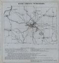
| Date: | 1930 |
|---|---|
| Description: | This map features a legend of highways, railroads, parks, and service stations. The cover and inside of the map features pictures of attractions in Madison... |

| Date: | 1930 |
|---|---|
| Description: | This map of Madison is 7 maps showing the city between 1885 and 1930. Each map has its own annotations of population growth, neighborhoods, and other cha... |

| Date: | 1930 |
|---|---|
| Description: | This map shows the western side of Madison, from Nakoma to the capitol. The map is oriented with north to upper right and the scale is indicated by quarter... |
If you didn't find the material you searched for, our Library Reference Staff can help.
Call our reference desk at 608-264-6535 or email us at:
