 Filter: Categories of Wisconsin Historical Images
Filter: FULL_DATE of 1930
Filter: Creator Name of Unknown
Filter: Type of Map or Atlas
Filter: Categories of Wisconsin Historical Images
Filter: FULL_DATE of 1930
Filter: Creator Name of Unknown
Filter: Type of Map or Atlas

| Date: | 1930 |
|---|---|
| Description: | Page 8 of the 1930 schedule is a map of the routes of the Goodrich Steamship Lines in Lake Michigan and Lake Huron. |

| Date: | 1930 |
|---|---|
| Description: | Map of the routes of the screw passenger and freight vessels of the Michigan Transit Company. Includes a picture of the Park Place hotel in Traverse City, ... |

| Date: | 1930 |
|---|---|
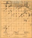
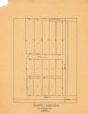
| Description: | These 40 hand-drawn maps depict the survey townships in Oneida County, Wisconsin, on printed township grids. Lakes, rivers, and waterfront properties are d... |

| Date: | 1930 |
|---|---|
| Description: | This manuscript map, likely drawn in the 1930s, shows Fox Lake, in Dodge County, Wisconsin, and the roads and resorts in the vicinity. |

| Date: | 1930 |
|---|---|
| Description: | This pictorial map from the first half of the 20th century shows the landmarks, highways, rail lines, and cities and villages in the vicinity of the Wiscon... |

| Date: | 1930 |
|---|---|
| Description: | Shows county system of roads which are surfaced, well graded, common, or unimproved, town roads, state trunk highways, town and village boundaries, schools... |

| Date: | 1930 |
|---|---|
| Description: | Shows county system of roads which are surfaced, well graded, common, or unimproved, town roads, state trunk highways, town and village boundaries, schools... |

| Date: | 1930 |
|---|---|
| Description: | Map of Ripon, Wisconsin. In the lower left hand corner is a list of points of interest that correspond with numbers on the map. Streets and Mill Pond are l... |

| Date: | 1930 |
|---|---|
| Description: | This map shows the western side of Madison, from Nakoma to the capitol. The map is oriented with north to upper right and the scale is indicated by quarter... |

| Date: | 1930 |
|---|---|
| Description: | This map has relief shown pictorially and shows plat of the city, block numbers, land ownership by name, local streets, railroads, mill pond, and part of G... |

| Date: | 1930 |
|---|---|
| Description: | This map shows a plat of the town, local streets, railroads, creeks, part of Fox River, and part of the bay of Green Bay. The location of the original fort... |
| Date: | 1930 |
|---|---|
| Description: | This map shows 6 types of zones, as well as cemeteries and streets and includes portions of Greenfield, West Allis, West Milwaukee, and the city of Milwauk... |
| Date: | 1930 |
|---|---|
| Description: | This map is pen and pencil on paper and shows local streets, lots by number, and section divisions. |

| Date: | 1930 |
|---|---|
| Description: | This map shows city wards, streets, railroads, parks, Lake Butte Des Morts, Lake Winnebago, advertisements for Dixie Oils Gasoline, a list of Cook & Brown ... |

| Date: | 1930 |
|---|---|
| Description: | This map shows rivers, lakes, trails, Indian villages, distances, and boundaries of tracts ceded by the Munnomonee, Winnebaygoes, and New York Indians Trib... |

| Date: | 1930 |
|---|---|
| Description: | This map shows surface types on the highways including: concrete, bit, mat, gravels, shales, and unsurfaced. County boundaries, cities, rivers, roads, high... |
| Date: | 1930 |
|---|---|
| Description: | This photocopy map includes cross section of buildings. |
If you didn't find the material you searched for, our Library Reference Staff can help.
Call our reference desk at 608-264-6535 or email us at:
