| Date: | 1927 |
|---|---|
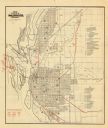
| Description: | This map includes an index and highways marked in red. Attractions on the map include: Four Mile House, Cold Springs, Grand Crossing Station, Coleman Sloug... |

| Date: | 1927 |
|---|---|
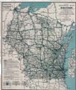
| Description: | This map shows the state trunk highway system and county trunk highways. The lower left corner includes a legend of roadway types. Lake Michigan and Lake S... |

| Date: | 1927 |
|---|---|
| Description: | This map details automobile routes throughout the state as well as parts of Iowa, Minnesota, Michigan and Illinois. Cities, the Mississippi River, Lake Mic... |
If you didn't find the material you searched for, our Library Reference Staff can help.
Call our reference desk at 608-264-6535 or email us at: