 Filter: Categories of Wisconsin Historical Images
Filter: FULL_DATE of 1925
Filter: Subject of trails
Filter: Categories of Wisconsin Historical Images
Filter: FULL_DATE of 1925
Filter: Subject of trails

| Date: | 1925 |
|---|---|
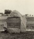
| Description: | The Pierre Pauquette monument located at the easterm terminus of the Wauona Trail. Erected by the Wau-bun Chapter of the Daughters of the American Revoluti... |
| Date: | 1925 |
|---|---|
| Description: | A view of the Pierre Pauquette monument located at the eastern terminus of the Wauona Trail. Erected by the Wau-bun Chapter of the Daughters of the America... |
| Date: | 1925 |
|---|---|
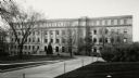
| Description: | Exterior of Birge Hall (Biology building) on the University of Wisconsin-Madison campus from Bascom Hill. |
| Date: | 1925 |
|---|---|
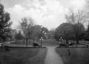
| Description: | Cars parked in the circular drive on the campus grounds at Bessie Tift College. The tree dotted lawn extends in all directions. |
| Date: | 1925 |
|---|---|
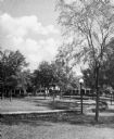
| Description: | A view of the campus green space at Bessie Tift College, with buildings in the background. The outdoor space includes trees, shrubs and lamp posts. |
| Date: | 1925 |
|---|---|
| Description: | A view of the green space and buildings on the campus of Bessie Tift College. Trees stand near the buildings and a fountain is to the right. |
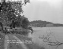
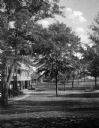
| Date: | 1925 |
|---|---|
| Description: | View down dirt road along the shoreline of Crystal Lake. A man and a child stand under a tree's shade, near a pier where a man is seated on the dock. There... |
| Date: | 1925 |
|---|---|
| Description: | Rock formations at Congress Hall on the Dell View Resort property. |
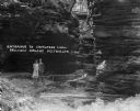
| Date: | 1925 |
|---|---|
| Description: | A man and woman pose at the wooden walkway among the rock formations of Congress Hall, on the Dell View Resort property. |
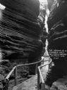
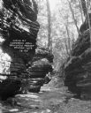
| Date: | 1925 |
|---|---|
| Description: | View down a narrow wooden walkway through rock formations at Congress Hall, on the Dell View Resort property. |

| Date: | 1925 |
|---|---|
| Description: | This 1925 map of Ashland County, Wisconsin, shows the township and range system, towns, sections, cities and villages, the Bad River Indian Reservation, ra... |

| Date: | 1925 |
|---|---|
| Description: | This map shows trails, mounds, villages, corn fields, and contemporary civil townships; some villages and features include both Indian and English place na... |
If you didn't find the material you searched for, our Library Reference Staff can help.
Call our reference desk at 608-264-6535 or email us at: