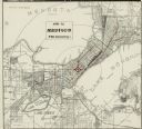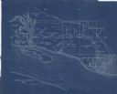
| Date: | 1920 |
|---|---|
| Description: | A map of Madison and the vicinity. Red lines show the street railway. |

| Date: | 1920 |
|---|---|
| Description: | This map shows the township and range system, sections, schools, churches, cemeteries, town halls, roads, railroads, and lakes and streams in Shawano Count... |

| Date: | 1920 |
|---|---|
| Description: | Shows wards and selected points of interest. Includes street index. Oriented with north to upper right. |

| Date: | 1920 |
|---|---|
| Description: | This blue print map and blue line print copy mounted on cloth shows land ownership by name, campus buildings, local streets, railroads, and part of Lake Me... |

| Date: | 1920 |
|---|---|
| Description: | This map shows wards, streets, railroads, parks, cemeteries, select buildings, and Lake Michigan. Also included is a street index. Cemeteries and parks are... |

| Date: | 1920 |
|---|---|
| Description: | This blueprint map covers the boundary area between Lake Superior and the Lac Vieux Desert. The map reads: "Land lines, streams, lakes, railroads, cities a... |

| Date: | 1920 |
|---|---|
| Description: | This hand-colored bird's-eye-view map shows roads, parks, golf club, schools, buildings, landscaping, and part of Lake Wingra. |

| Date: | 1920 |
|---|---|
| Description: | This blue line print map shows land claimed by the state and land claimed by Michigan, including disputed areas between the Branch River and Brule Lake and... |

| Date: | 1920 |
|---|---|
| Description: | This blue line print map shows the forks of the Montreal River. The East Branch and West Branch are labeled, with arrows showing the flow of the river. |

| Date: | 1920 |
|---|---|
| Description: | This blue print map shows landownership between 1913 and 1916, topography, railroads, and roads. The map covers the vicinity of Perrot State Park. |
If you didn't find the material you searched for, our Library Reference Staff can help.
Call our reference desk at 608-264-6535 or email us at: