Filter: Categories of Wisconsin Historical Images
Filter: FULL_DATE of 1915
Filter: Type of Map or Atlas
Filter: Categories of Wisconsin Historical Images
Filter: FULL_DATE of 1915
Filter: Type of Map or Atlas

| Date: | 1915 |
|---|---|
| Description: | This manuscript blueprint map oriented with north to the upper right. The map includes street names, certifications, and registration. Streets left to righ... |

| Date: | 1915 |
|---|---|
| Description: | This map shows streets and lots with prices available through the Madison Realty Company. Some of the plats include legends. The areas include: Brooks' Add... |

| Date: | 1915 |
|---|---|
| Description: | This map shows roads, railroads, street railways, abandoned logging railroads, rural mail routes, telephone lines, schools, platted land, and state forest ... |

| Date: | 1915 |
|---|---|
| Description: | This map includes automobile routes through the state as well as routes in parts of Iowa, Michigan and Minnesota. Cities, counties, Lake Michigan, Lake Sup... |

| Date: | 1915 |
|---|---|
| Description: | This map displays various automobile routes through the state of Wisconsin and parts of Illinois, Iowa, Minnesota, and Michigan. Cities, counties, Lake Mic... |

| Date: | 1915 |
|---|---|
| Description: | This map shows highways in the state and includes in the left bottom margin information on the population to be served by proposed roads. There are handwri... |
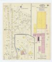
| Date: | 1915 |
|---|---|
| Description: | A Sanborn map of a portion of Janesville, including the Rock River Sugar Company. |

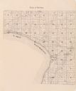
| Date: | 1915 |
|---|---|
| Description: | A composite plat map of the towns of Mequon, Saukville, Belgium, Fort Washington, and Fredonia. |

| Date: | 1915 |
|---|---|
| Description: | A Sanborn fire insurance map of Sauk City created in 1915. |

| Date: | 1915 |
|---|---|
| Description: | A Sanborn fire insurance map of Sauk City created in 1915. |
If you didn't find the material you searched for, our Library Reference Staff can help.
Call our reference desk at 608-264-6535 or email us at: