| Date: | 1914 |
|---|---|
| Description: | This map is a photostat copy from the original 1829 map in the War Department. The map shows location of Fort Howard, lots, land claims of Jacques Porlier ... |

| Date: | 1914 |
|---|---|
| Description: | A hand-drawn and colored map of the Milwaukee Township, showing how lands were used, included are parks, cemeteries, private grounds, and speculative land.... |

| Date: | 1914 |
|---|---|
| Description: | This early-20th century map of Clark County, Wisconsin, shows the township and range grid, sections, cities and villages, wagon roads, railroads, settlers,... |

| Date: | 1914 |
|---|---|
| Description: | Shows lot numbers and dimensions; covers portion of the neighborhood currently known as Shorewood Hills. Includes red annotations showing houses and sold l... |

| Date: | 1914 |
|---|---|
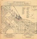
| Description: | Includes index of University of Wisconsin buildings, churches, and public buildings. Top of Map reads: '"GET A SQUARE DEAL" AT THE COLLEGE BOOK STORE SHOWN... |

| Date: | 1914 |
|---|---|
| Description: | This map has relief shown by hachures and shows local streets, wards, districts, railroads, Fox River, and part of Bay of Green Bay. Wards are shown in dar... |

| Date: | 1914 |
|---|---|
| Description: | This photostat map shows Fort Winnebago around 1931, land to be reserved for military purposes, roads to Fort Howard and Fort Crawford, "private property" ... |

| Date: | 1914 |
|---|---|
| Description: | This blueprint map includes manuscript annotations in red and shows number of acres and dates of acquisition (1905-1914) of each parcel of land, as well as... |

| Date: | 1914 |
|---|---|
| Description: | Pg. 44 West Half of Marion Township. Pg. 45 East Half of Marion Township. |

| Date: | 1914 |
|---|---|
| Description: | A farmer's directory of Marion Township listing farmers and locations of their farms. |
If you didn't find the material you searched for, our Library Reference Staff can help.
Call our reference desk at 608-264-6535 or email us at: