Filter: Categories of Wisconsin Historical Images
Filter: FULL_DATE of 1911
Filter: Community of Madison
Filter: Subject of water
Filter: Categories of Wisconsin Historical Images
Filter: FULL_DATE of 1911
Filter: Community of Madison
Filter: Subject of water

| Date: | 1911 |
|---|---|
| Description: | Map of the west part of the city of Madison. |

| Date: | 1911 |
|---|---|
| Description: | View from Lake Mendota of the University of Wisconsin-Madison lower campus. The Armory (Red Gym or Old Red) is behind the boathouse, with the domed Bascom ... |

| Date: | 1911 |
|---|---|
| Description: | A map of the Racine, Kenosha, and portions of Milwaukee counties, that shows the townships in Racine and Kenosha, and the townships of Brookfield, New Berl... |

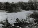
| Date: | 1911 |
|---|---|
| Description: | Cascades of the Yahara River at Tenney Park. Caption reads: "The Cascades, Tenney Park, Madison, Wis." |
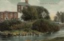
| Date: | 1911 |
|---|---|
| Description: | View from shoreline across river towards an industrial building near the Yahara River. A bridge is behind trees and bushes on the right. Caption reads: "Te... |
If you didn't find the material you searched for, our Library Reference Staff can help.
Call our reference desk at 608-264-6535 or email us at: