| Date: | 1900 |
|---|---|
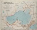
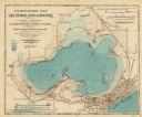
| Description: | Hydrographic map of Lake Mendota and it's adjacent topography. Prepared from surveys made by civil engineering students, University of Wisconsin, classes 1... |

| Date: | 1900 |
|---|---|
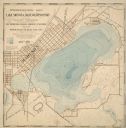
| Description: | A hydrographic map of Lake Monona and the adjacent topography. |

| Date: | 1900 |
|---|---|
| Description: | A Hydrographic map of Lake Mendota that shows the depths of the lake through contour lines and cross sections of the lake. Also shown in the map are the ad... |

| Date: | 1900 |
|---|---|
| Description: | This map shows the expansion of the University of Wisconsin-Madison campus growth between the years of 1850 and 1900. The map is indexed by building name a... |

| Date: | 1900 |
|---|---|
| Description: | This map shows the additions made in January 1855, as well as houses, streets, Catfish Creek, and the Milwaukee and Mississippi Rail Road and Depot. It als... |
If you didn't find the material you searched for, our Library Reference Staff can help.
Call our reference desk at 608-264-6535 or email us at: