 Filter: Categories of Wisconsin Historical Images
Filter: FULL_DATE of 1899
Filter: Subject of architecture
Filter: Type of Map or Atlas
Filter: Categories of Wisconsin Historical Images
Filter: FULL_DATE of 1899
Filter: Subject of architecture
Filter: Type of Map or Atlas

| Date: | 1899 |
|---|---|
| Description: | Topographical map showing ridges, water courses, boundary lines, and trails and roads near the Stanley McCormick's Riven Rock estate in El Montecito, Santa... |
| Date: | 1899 |
|---|---|
| Description: | Map of the Santa Barbara Channel California area showing property boundaries and some geographical features. The Riven Rock Estate has been outlined in yel... |

| Date: | 1899 |
|---|---|
| Description: | This 1899 map of Dodge County, Wisconsin, shows the township and range grid, towns, sections, cities and villages, roads, railroads, post offices, cemeteri... |

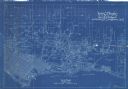
| Date: | 1899 |
|---|---|
| Description: | A map of the west part of the city of Madison, including University Heights and the Capitol Square. |
If you didn't find the material you searched for, our Library Reference Staff can help.
Call our reference desk at 608-264-6535 or email us at: