| Date: | 1896 |
|---|---|
| Description: | Section 2 of 12, this bicycle road map features Wisconsin bicycle routes in the counties of Marquette, Green Lake, Columbia, Fond Du Lac, Dodge, Washington... |

| Date: | 1896 |
|---|---|
| Description: | Section 3 of 12, this bicycle road map features Wisconsin bicycle routes in the counties of Winnebago, Calumet, Manitowoc, Outagamie, Brown, Kewaunee, and ... |

| Date: | 1896 |
|---|---|
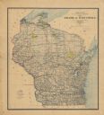
| Description: | This hand-colored map shows counties, county seats, cities, towns, proposed and completed railroads, and U.S. Land Offices. Also included in the map are th... |

| Date: | 1896 |
|---|---|
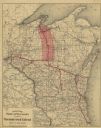
| Description: | A map showing the Wisconsin Central Railroad lines in Wisconsin, northern Illinois, eastern Minnesota, and Michigan’s Upper Peninsula. The area of the map ... |

| Date: | 1896 |
|---|---|
| Description: | A map of Milwaukee County, Wisconsin that shows the township and range system, sections, towns, roads, railroads and rail stations, cities and villages, po... |

| Date: | 1896 |
|---|---|
| Description: | Map highlighting parks and other points of interest in Milwaukee. |

| Date: | 1896 |
|---|---|
| Description: | This map shows streets, wards, railroads, parks, cemeteries, and Lake Michigan. Also included are explanations and an index of points of interest. |

| Date: | 1896 |
|---|---|
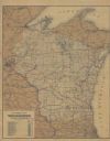
| Description: | This map shows railroad routes in red, blue, orange, brown, pink, green, and dotted, as well as lakes, rivers, and communities. The map includes a legend i... |

| Date: | 1896 |
|---|---|
| Description: | This map shows the railroad routes of the Wisconsin Central Railroad and its land grant. These are visibly marked in the color red. County boundaries are a... |
If you didn't find the material you searched for, our Library Reference Staff can help.
Call our reference desk at 608-264-6535 or email us at: