Filter: Categories of Wisconsin Historical Images
Filter: FULL_DATE of 1891
Filter: Subject of water
Filter: Categories of Wisconsin Historical Images
Filter: FULL_DATE of 1891
Filter: Subject of water
| Date: | 1891 |
|---|---|
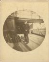
| Description: | Frederick Layton standing on deck smoking a cigar while at sea in a Kodak #2 camera portrait by T.W. Ingersoll from St. Paul, Minnesota. The photographer's... |

| Date: | 1891 |
|---|---|
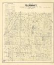
| Description: | This blueprint manuscript map shows land owned by Green Bay & Mississippi Canal Co., Meade, Vilas, Patten, and Hewitt. Streets and the Fox River are labele... |

| Date: | 1891 |
|---|---|
| Description: | This blueprint manuscript map shows land owned by Kaukauna Water Power Co., Green Bay & Mississippi Canal Co., A.W. Patten, N.M. Edwards, and M.J. Meade. P... |

| Date: | 1891 |
|---|---|
| Description: | This map shows soft marshland, water channels, solid ground, club boundary and shooting boxes. Big Lake, First Channel, Second Channel, Fout Mile Pond, Mal... |

| Date: | 1891 |
|---|---|
| Description: | This map shows soft marshland, water channels, solid ground, club boundary and shooting boxes. Big Lake, First Channel, Second Channel, Fout Mile Pond, Mal... |

| Date: | 1891 |
|---|---|
| Description: | View across water towards the steamboat "Satirio," owned by Henry Ainsworth. There is an American flag flying from the prow, and a banner hanging off the e... |

| Date: | 1891 |
|---|---|
| Description: | The index page of a Sanborn Map of Stevens Point. |
If you didn't find the material you searched for, our Library Reference Staff can help.
Call our reference desk at 608-264-6535 or email us at: