| Date: | 1872 |
|---|---|
| Description: | Map of the Chippewa River, from the head of navigation at the city of Chippewa Falls, covering a distance of 16 miles above : showing the established impro... |

| Date: | 1872 |
|---|---|
| Description: | Map entitled Office Wallbridge Bro. U. Sargent showing upper Minnesota and Wisconsin, as well as Lake Superior. |

| Date: | 1872 |
|---|---|
| Description: | Shows landowners, buildings, lot numbers, roads and railroads. Includes Menasha business directory. |

| Date: | 1872 |
|---|---|
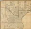
| Description: | This map shows wards, roads, railroads, lot and block numbers, subdivisions, parks, some landownership, and a race course. Manuscript annotations in red in... |
If you didn't find the material you searched for, our Library Reference Staff can help.
Call our reference desk at 608-264-6535 or email us at: