 Filter: Categories of Wisconsin Historical Images
Filter: FULL_DATE of 1865
Filter: Creator Name of United States. Engineer Department.
Filter: Subject of battles
Filter: Categories of Wisconsin Historical Images
Filter: FULL_DATE of 1865
Filter: Creator Name of United States. Engineer Department.
Filter: Subject of battles
| Date: | 1865 |
|---|---|
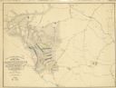
| Description: | This map of the battlefield shows U.S. infantry positions in blue, U.S. cavalry positions in yellow, Confederate positions in red, roads, drainage, vegetat... |

| Date: | 1865 |
|---|---|
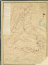
| Description: | Map extends from Harper's Ferry in the north to Petersburg in the south and from Lexington east to Heathsville. The routes of the II, V, VI, IX, XVIII, and... |

| Date: | 1865 |
|---|---|
| Description: | This detailed map of the area between Richmond and Petersburg shows fortifications, roads, railroads, towns, street patterns of Petersburg and Richmond, dr... |
| Date: | 1865 |
|---|---|
| Description: | This map shows the seven raids made in central Virginia by cavalry under the command of Maj. Gen. Philip H. Sheridan between May 9, 1864, and May 3, 1865. |

| Date: | 1865 |
|---|---|
| Description: | This map illustrates the lines of defense established by Confederate troops, under the command of General Joseph E. Johnston, at Raleigh, North Carolina, i... |
If you didn't find the material you searched for, our Library Reference Staff can help.
Call our reference desk at 608-264-6535 or email us at: