| Date: | 1856 |
|---|---|
| Description: | Wisconsin map illustrating the Mineral Point Railroad and its connections. |

| Date: | 1856 |
|---|---|
| Description: | Map of a portion of Douglas and La Pointe counties situated on Lake Superior. |

| Date: | 1856 |
|---|---|
| Description: | A map showing rail lines in Wisconsin and the railroad land grants of the Superior & St. Croix Railroad in the present-day northwestern Wisconsin counties ... |

| Date: | 1856 |
|---|---|
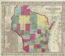
| Description: | A hand-colored map of Wisconsin, showing the county boundaries, towns, cities, railroads, roads, lakes, rivers, bays, and the Lake Superior’s islands. In ... |

| Date: | 1856 |
|---|---|
| Description: | This map shows the entire state of Wisconsin with counties, cities and rivers. It includes an inset of the layout of the streets of Milwaukee and a chart w... |

| Date: | 1856 |
|---|---|
| Description: | This map depicts the route of the La Crosse and Milwaukee Railroad in Wisconsin. Other railroads in Wisconsin, northern Michigan, and northern Illinois wit... |

| Date: | 1856 |
|---|---|
| Description: | This map of Bayfield shows a plat of the town, roads, and part of Lake Superior. Relief is shown by hachures. The right margin of the map includes illustra... |

| Date: | 1856 |
|---|---|
| Description: | This map shows land ownership by name, a plat of Bayfield, local streets, part of Lake Superior, part of Madeline Island, and part of Bass Island. La Point... |

| Date: | 1856 |
|---|---|
| Description: | This map shows the railroad routes and connection of the Mineral Point Railroad. Lake Michigan is on the far right, while Lake Superior is at the top of th... |

| Date: | 1856 |
|---|---|
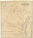
| Description: | This map shows the railroad routes that lead to Milwaukee. Included are portions of Minnesota, Iowa and Illinois. Lake Michigan is on the right, while Lake... |

| Date: | 1856 |
|---|---|
| Description: | This map shows township grids, existing settlements, Indian reservations, rivers, lakes, and treaty lines. Included is a portion of Minnesota. Lake Michiga... |
If you didn't find the material you searched for, our Library Reference Staff can help.
Call our reference desk at 608-264-6535 or email us at: