 Filter: Categories of Wisconsin Historical Images
Filter: FULL_DATE of 1856
Filter: Creator Name of United States. Surveyor General.
Filter: Categories of Wisconsin Historical Images
Filter: FULL_DATE of 1856
Filter: Creator Name of United States. Surveyor General.
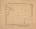
| Date: | 1856 |
|---|---|
| Description: | Shows sections and acreages. Covers portions of the area now occupied by Marinette and the Town of Peshtigo, Marinette County. "Rec’d Sept. 24 with Sur. Ge... |
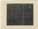
| Date: | 1856 |
|---|---|
| Description: | This map shows township grids, existing settlements, Indian reservations, rivers, lakes, and treaty lines. Included is a portion of Minnesota. Lake Michiga... |
If you didn't find the material you searched for, our Library Reference Staff can help.
Call our reference desk at 608-264-6535 or email us at: